")
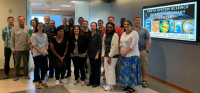
Ron Vogel, ESSIC / CISESS Senior Faculty Specialist, and NOAA colleague Michelle Tomlinson, taught a three-day intensive course at the Earth System Science Interdisciplinary Center on utilizing oceanographic satellite data in environmental research and in coastal and marine decision-making applications.
Designed for those with limited or no knowledge of remote sensing, the course includes a series of lectures on oceanographic remote sensing and hands-on software lab activities to help in the discovery and analysis of satellite data. Each student brought a project relevant to their own work and was tasked with submitting a project slide showing how they were able to use the data for their environmental research or management application.
The eighteen participants included employees from NOAA, NASA, Maryland Department of Natural Resources, The Nature Conservancy, and Virginia’s Prince William County Soil and Water Department, as well as students from University of Maryland, Baltimore County.
In his research, Vogel applies earth-observation satellite data to environmental decision-making. He currently develops decision-support tools for water quality, fisheries and climate change in coastal areas. Other interests include ecological modeling with satellite data and vegetation and land surface monitoring by satellite. He has expertise in both visible and infrared satellite remote sensing.
For more information on Vogel’s research, see his website here: https://eastcoast.coastwatch.noaa.gov/.


