Radar Outage Costs and the Value of Alternate Datasets
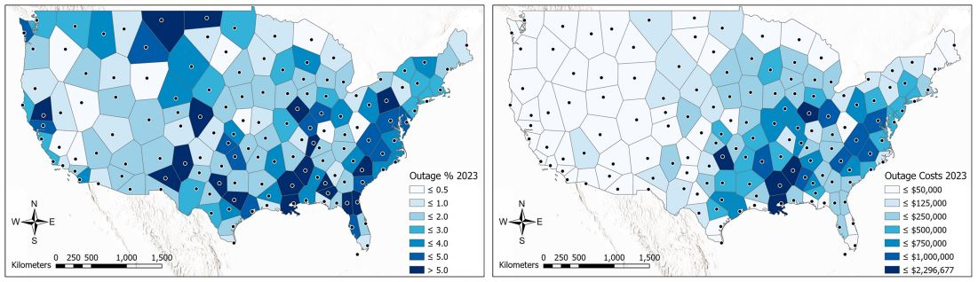
Figure. Example of (left panel) radar outage frequency and (right panel) radar outage cost estimates for the year 2023. Weather radars are crucial tools for
")
Figure. Example of (left panel) radar outage frequency and (right panel) radar outage cost estimates for the year 2023. Weather radars are crucial tools for
ESSIC/CISESS Scientists Daile Zhang, Scott Rudlosky (NOAA), and colleagues published a study that uses the well-documented Tropical Rainfall Measuring Mission (TRMM) Lightning Imaging Sensors (LIS) performance to determine if the International Space Station (ISS) LIS performs well enough to bridge the gap between TRMM LIS and the new generation of Geostationary Lightning Mappers (GLMs).
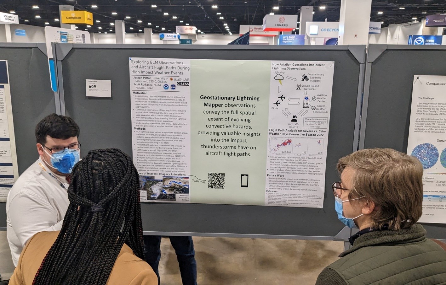
The ESSIC/CISESS Lightning Group presented five oral talks and four posters (two at the Student Conference) at the 2023 AMS Annual Meeting in Denver, CO.

Last week, NOAA Administrators announced the recipients of the 2022 Bronze Medal, Distinguished Career, Administrator’s Awards, and Recognition Awards for 50 Years of Service. Among the awardees were several ESSIC scientists.
The ESSIC/CISESS Geostationary Lightning Team team, which includes Scott Rudlosky and Daile Zhang, have released a new ArcGIS Story Map via the NOAA GeoPlatform titled “Longest Lightning Flash Ever?”. This website provides stunning visualizations of a recently documented world record flash that covered a horizontal distance of 768 km (477.2 miles) on April 29, 2020. This is equivalent to the distance between New York City and Columbus, Ohio. This flash was recently certified as the longest single flash world record, as covered in an ESSIC press release.
Scott Rudlosky and Joseph Patton led an AMS short course titled “Accessing and Applying Geostationary Lightning Mapper Observations” on January 5 and 6. This two-part course introduced the GLM observations and imagery using GLM flash skeletons and gridded products used by the National Weather Service. Participants were shown how to access archived and real-time imagery before conducting a hands-on exercise illustrating their new-found skills. Additional information can be found at this link: Accessing and Applying Geostationary Lightning Mapper Observations.
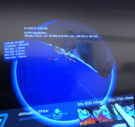
ESSIC/CISESS Visiting Assistant Research Scientists Mason Quick and Scott Rudlosky and CISESS Faculty Specialist Eric Lee recently participated in a video interview with reporters from Voice of America to highlight their cutting-edge virtual reality software that uses 3-D mapping to improve weather forecasting.
The ESSIC/CISESS lightning team, composed of Scott Rudlosky, Mason Quick, Jonathan Smith, and Daile Zhang, organized and presented at the 2020 annual Geostationary Lightning Mapper (GLM) Science Meeting earlier this month.
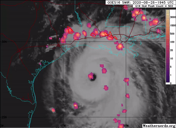
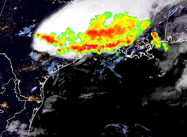
The Advanced Microwave Scanning Radiometer 2 (AMSR2) onboard the GCOM-W1 satellite captured Hurricane Laura, the deadly Category 4 hurricane that hit Louisiana in late August. AMSR2 is a remote sensing instrument used to measure weak microwave emission from Earth’s surface and atmosphere. SCSB- and CISESS-led products captured Hurricane Laura at various stages of development. Visiting Assistant Research Scientist Scott Rudlosky shared several images to his Twitter feed, which show considerable lightning around the eye wall during Laura’s intensification.
ESSIC/CISESS scientists Scott Rudlosky (SCSB) and Daile Zhang along with former CICS scientist Michael Peterson recently collaborated on two articles concerning the appearance of lightning flashes and thunderstorm clouds.
