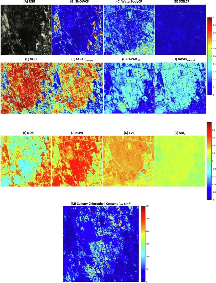
Home » qingyuan zhang

Tag: qingyuan zhang

Figure: The VIIRS Flood map, Sentinel-1 SAR Flood map, and the comprehensively blended Flood map on 10/2/2022 reporting flood extent due to Hurricane Ian.

Florida Flood Maps for Hurricane Ian

Hurricane Ian made landfall in Florida on the afternoon of 9/28/2022 as a massive Category 4 storm and brought record-setting winds. As of 10/4/2022, at least 105 people have been reported as casualties of Hurricane Ian, 55 of which in Lee County, Florida. Even more people are without power or their home. The NOAA STAR Flood team has produced VIIRS Flood maps, Sentinel-1 SAR Flood maps, and blended Flood maps to report the flood extent due to Hurricane Ian.

Read More »
Figure. The 6 × 6 km2 Howland forest area in Maine: (A) the true color image obtained by the EO-1 Hyperion on March 5, 2014 (DOY 64) at a spatial resolution of 30 m; and maps of (B) snow cover fraction (SNOWCF); (C) surface water cover fraction (WaterBodyCF); (D)soil cover fraction (SOILCF); (E) vegetation cover fraction (VGCF); (F) fAPARcanopy; (G) fAPARchl; (H) fAPARnon-chl.

An Evergreen Forest Ecosystem from Satellites

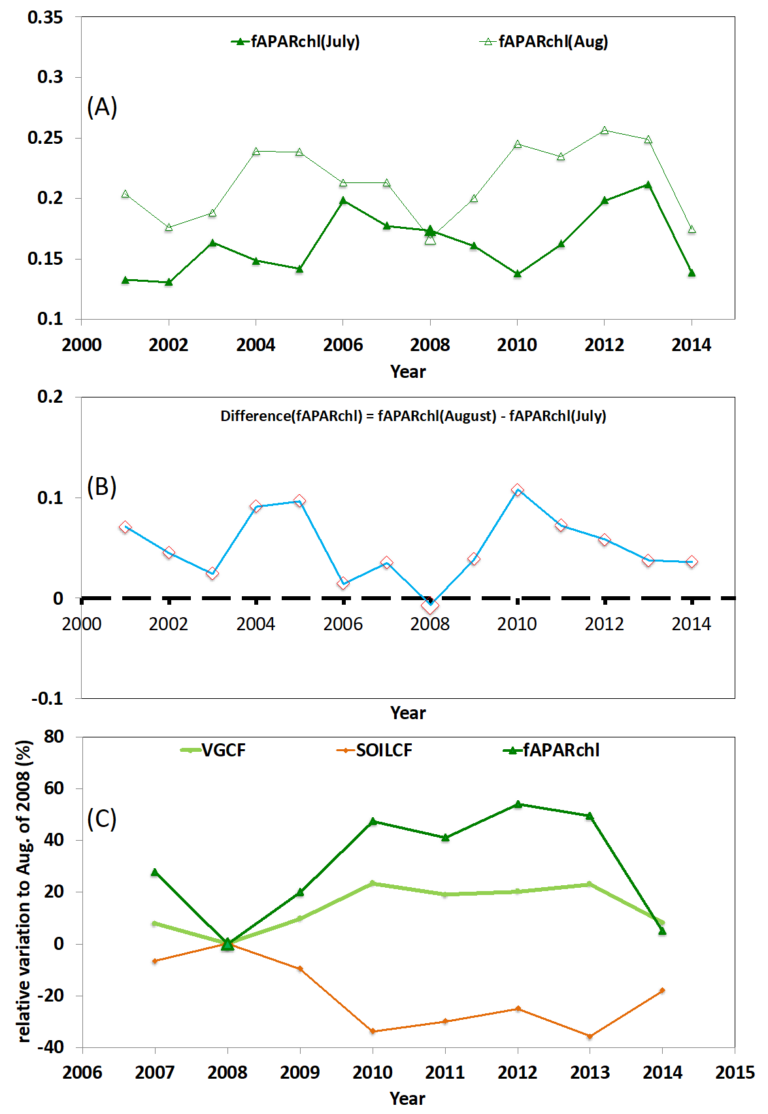
ESSIC/CISESS Scientist Qingyuan Zhang has a new article to be published in International Journal of Applied Earth Observation and Geoinformation that characterizes the seasonally snow-covered Howland boreal forest ecosystem in Maine, USA with satellite images.

Read More »