Home » NASA » Page 2

Tag: NASA

Global shallow groundwater from 2003 to 2021. Credits: NASA

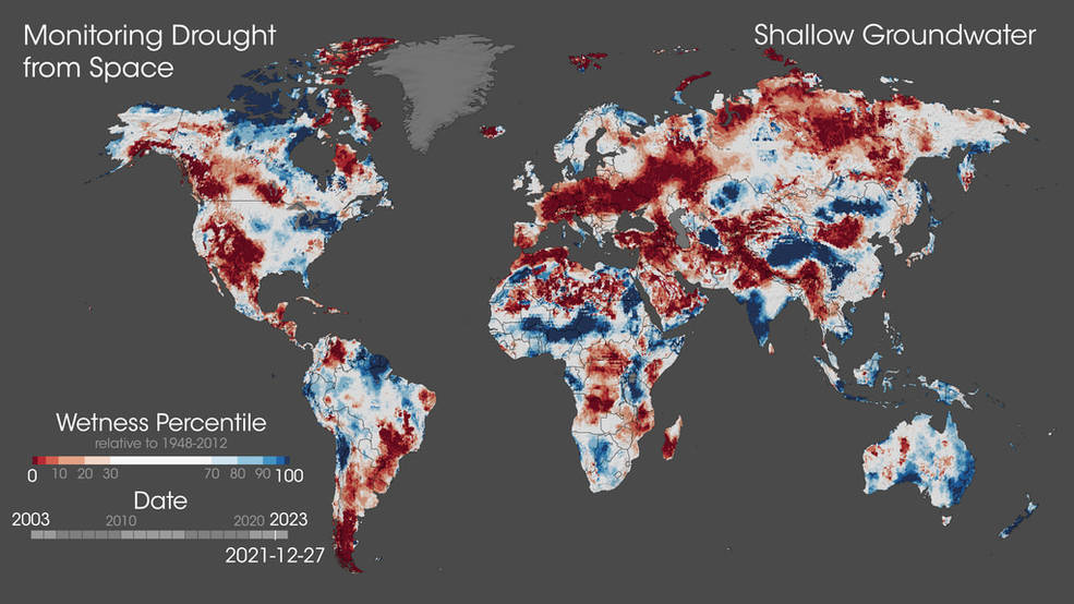
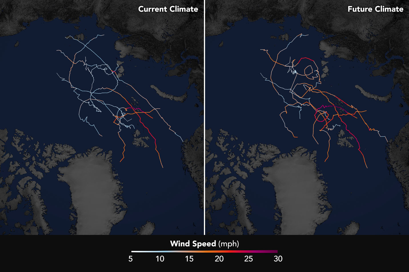
Warming Makes Droughts, Extreme Wet Events More Frequent, Intense

Scientists have predicted that droughts and floods will become more frequent and severe as our planet warms and climate changes, but detecting this on regional and continental scales has proven difficult. Now a new UMD and NASA study confirms that major droughts and pluvials – periods of excessive precipitation and water storage on land – have indeed been occurring more often.

Read More »
The maps above show simulated storm tracks and wind speeds of nine Arctic cyclones. The left image represents simulated storm tracks as they hit the Arctic in the past decade. The right image shows how the cyclones are projected to respond to climate change by the end of the century. Credits: NASA Earth Observatory/Joshua Stevens, using data from Parker, C.L. et al.

Arctic Cyclones to Intensify as Climate Warms

In findings published on Nov. 9, a team of NASA scientists led by ESSIC research scientist Chelsea Parker project spring Arctic cyclones will intensify by the end of this century because of sea ice loss and rapidly warming temperatures. Those conditions will lead to stronger storms that carry warmer air and more moisture into the Arctic.

Read More »
Caption: The Water Point Viewer’s current water points stretch from Mali to Somalia.

ESSIC Scientist Expands Water Availability Prediction in East and West Africa

ESSIC Researcher Kimberly Slinski is the Principal Investigator on “Earth Observation-Based Monitoring and Forecasting of Rangeland Water Resources”, a newly funded project that aims to develop new capabilities for monitoring and forecasting water availability in African rangeland ponds. The project team includes Shrad Shukla and Chris Funk of the University of California Santa Barbara, Mike Jasinski of NASA GSFC, and Gabriel Senay of USGS.

Read More »
Frank Monaldo in the video

NASA/NOAA Tech Will Aid Marine Oil Spill Response

As part of the NASA grant, UMD, NASA Jet Propulsion Laboratory, NOAA, United States Coast Guard, Watermapping Ltd., Maryland Department of Agriculture, Environment Canada, and Marine Spill Response Corporation participated in an experiment to compare oil thickness measurements (both in situ and remotely) in the hopes of validating an oil thickness product. By finding the thickest oil layers, researchers can identify key zones to bring in remediation equipment and clean up the most harmful oil in the environment. ESSIC Senior Faculty Specialist Frank Monaldo is involved in this field work and is featured in a video that highlights this work.

Read More »