Home » jun dong

Tag: jun dong

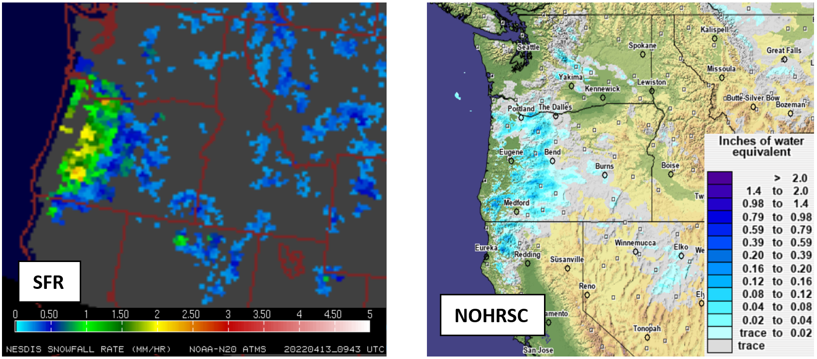
Figures 1 and 2: Snowfall rate from Pacific Northwest snowstorm on April 13, 2022, (left) NOAA-20 SFR, (right) NOHRSC

Microwave Snowfall Rate Product Captures Late Season Pacific Northwest Snowfall

The STAR scientist team of Huan Meng, Yongzhen Fan, Jun Dong, and Yalei You examined the performance of snowfall estimates from the passive microwave snowfall rate (SFR) product for the late season snowstorm that hit Washington and Oregon on April 13. The storm set the local record for most snow accumulation this late in the season, causing power outages and road closures across Portland, Oregon.

Read More »
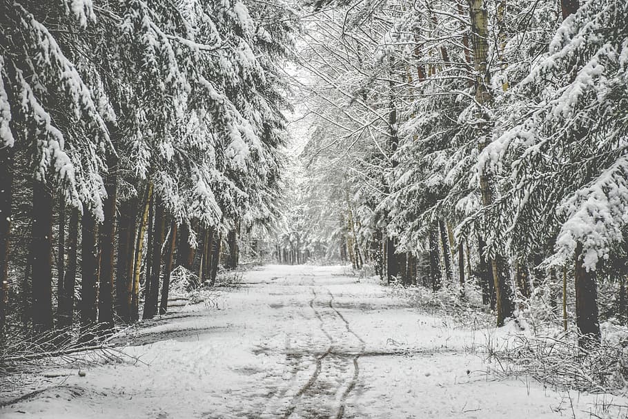
Snow falling around some pine trees

Snowfall Rate Product Captures First Nor’easter in 2022

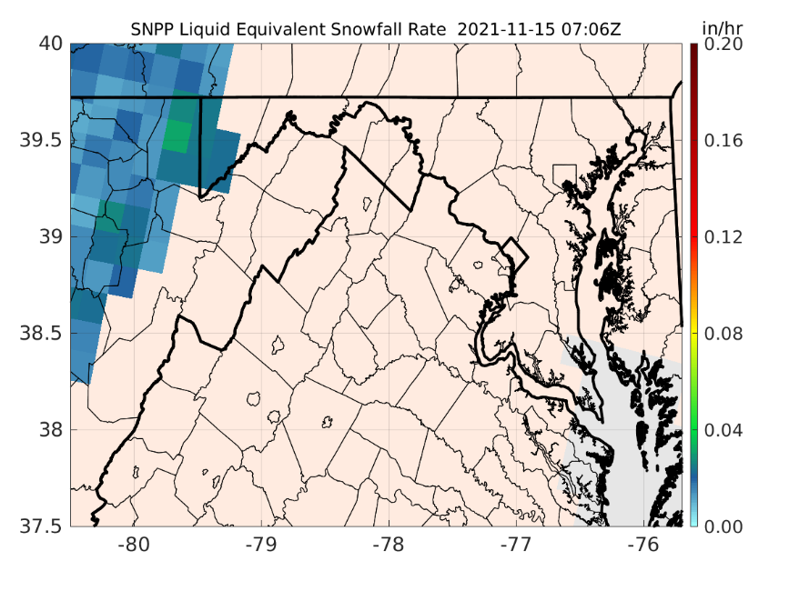
The first nor’easter of 2022 swept through the Mid-Atlantic and the Northeast on January 2-4, 2022, resulting in a heavy snow accumulation of up to 14 inches in Virginia and southern Maryland and stranding hundreds of drivers on Interstate 95 in Virginia. The NOAA NESDIS Snowfall Rate (SFR) product captured the evolution of the snowstorm with retrievals from the Advanced Technology Microwave Sounder (ATMS) sensor aboard the S-NPP and NOAA-20 satellite missions, and the AMSU-A/MHS sensors aboard NOAA-19, Metop-B, and Metop-C.

Read More »
Figure: S-NPP SFR during the first accumulating snow of the 2021-2022 winter season in the central Appalachian counties.

Snowfall Rate Page for Local NWS Office

The ESSIC/CISESS snowfall rate (SFR) team, Huan Meng, Jun Dong, and Yongzhen Fan, set up a webpage for the NWS Sterling, VA Weather Forecast Office (Office Call Sign: LWX) at the request of Luis Rosa, a senior forecaster from the office. The page is set for the LWX county warning area (CWA). Currently, the page has the operational SFR images from five satellites but will be expanded to include the experimental SFR from four other satellites. The SFR product is produced at CISESS from direct broadcast data retrieved from the University of Wisconsin. The product latency ranges from 12-25 min depending on the satellite.
Read More »
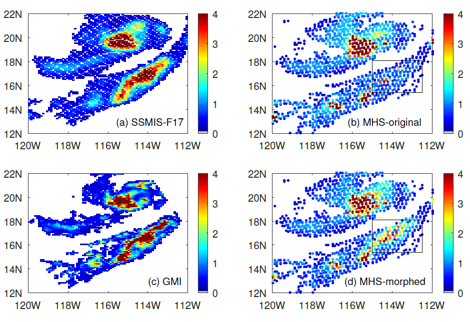
Figure: This is a precipitation event on 29 August 2020 over the Pacific Ocean near the lower California peninsula. (a) the cross-track radiometer precipitation data, (b) the conical scanning radiometer precipitation data, (c) the reference data for the event, and (d) the “morphed” radiometer precipitation data. The box shows the area of improvement due to morphing.

Improving Satellite Precipitation Retrieval

ESSIC/CISESS Scientists Yalei You, John Xun Yang, and Jun Dong have a new article on using “morphing” to improve rain data from cross-track scanning radiometers. The paper, titled “Improving Cross-track Scanning Radiometers’ Precipitation Retrieval over Ocean by Morphing”, is in press at the Journal of Hydrometeorology.

Read More »