Home » john xun yang

Tag: john xun yang

SatERR is a bottom-up approach, where the four types of errors including measurement, preprocessing, observation operator, and representativeness errors are generated from sources and forward propagate through radiances, science products, and data assimilation systems. This approach can quantify and partition errors and uncertainties in science products, and capture leading features of the most important errors in a statistical sense for data assimilation.

Leveraging Satellite Observations with a Comprehensive Simulator

Satellite observations are vital for weather forecasts, climate monitoring, and environmental studies. In recent years, there has been a concerted effort to develop methods for quantifying and representing errors associated with satellite observations. ESSIC scientist John Xun Yang has led a team of scientists in the creation of an error inventory simulator, the Satellite Error Representation and Realization (SatERR).

Read More »
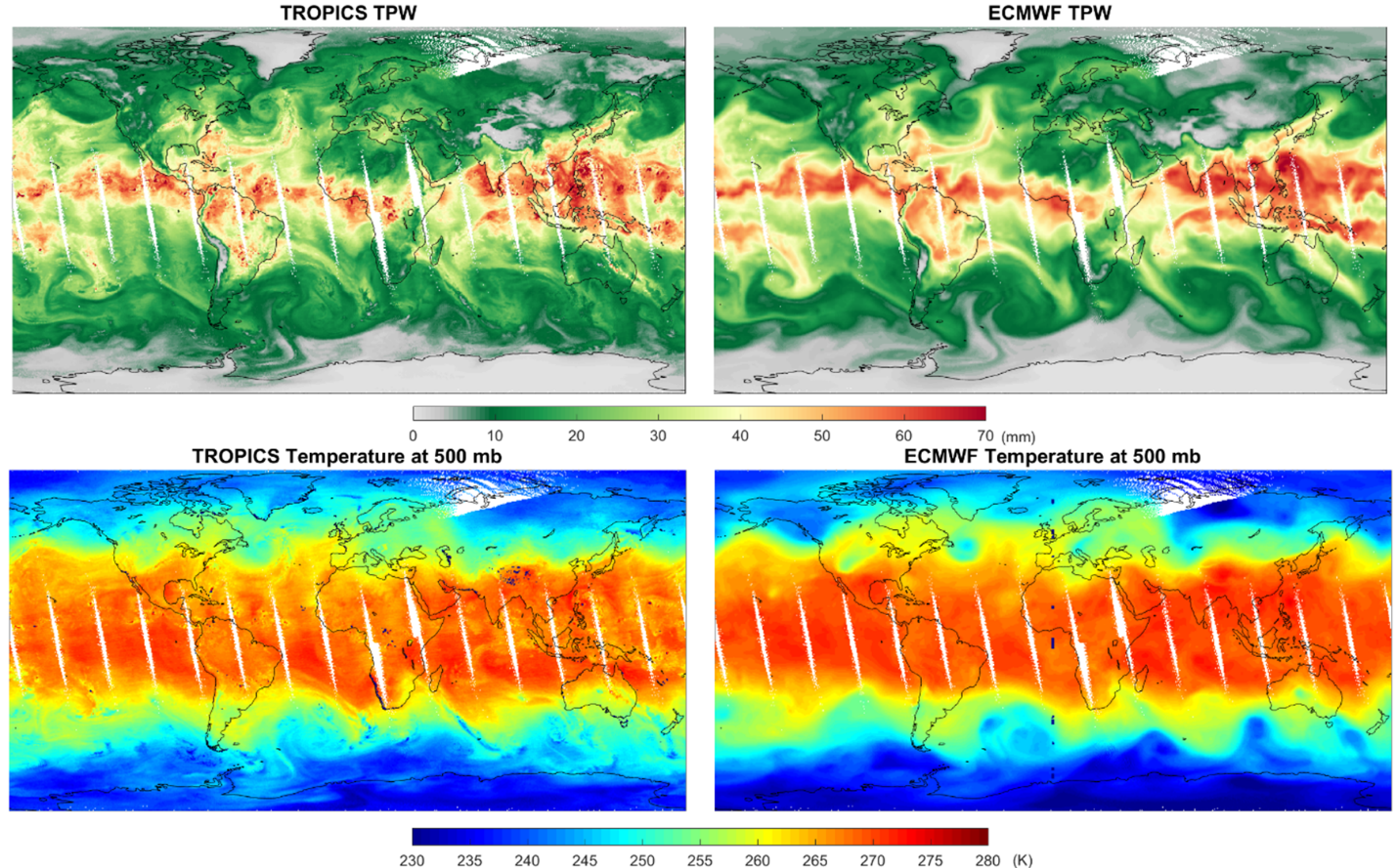
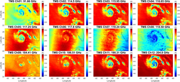
Fig 1. The retrieved total precipitable water (TPW) and temperature (500 mb) from TROPICs are in good agreement with ECMWF analysis.

Atmospheric Sounding from the CubeSat TROPICS Mission

ESSIC/CISESS scientists John Xun Yang, Yong-Keun Lee, and Christopher Grassotti are co-authors on a new paper titled “Atmospheric humidity and temperature sounding from the CubeSat TROPICS mission: Early performance evaluation with MiRS” in Remote Sensing of Environment.

Read More »
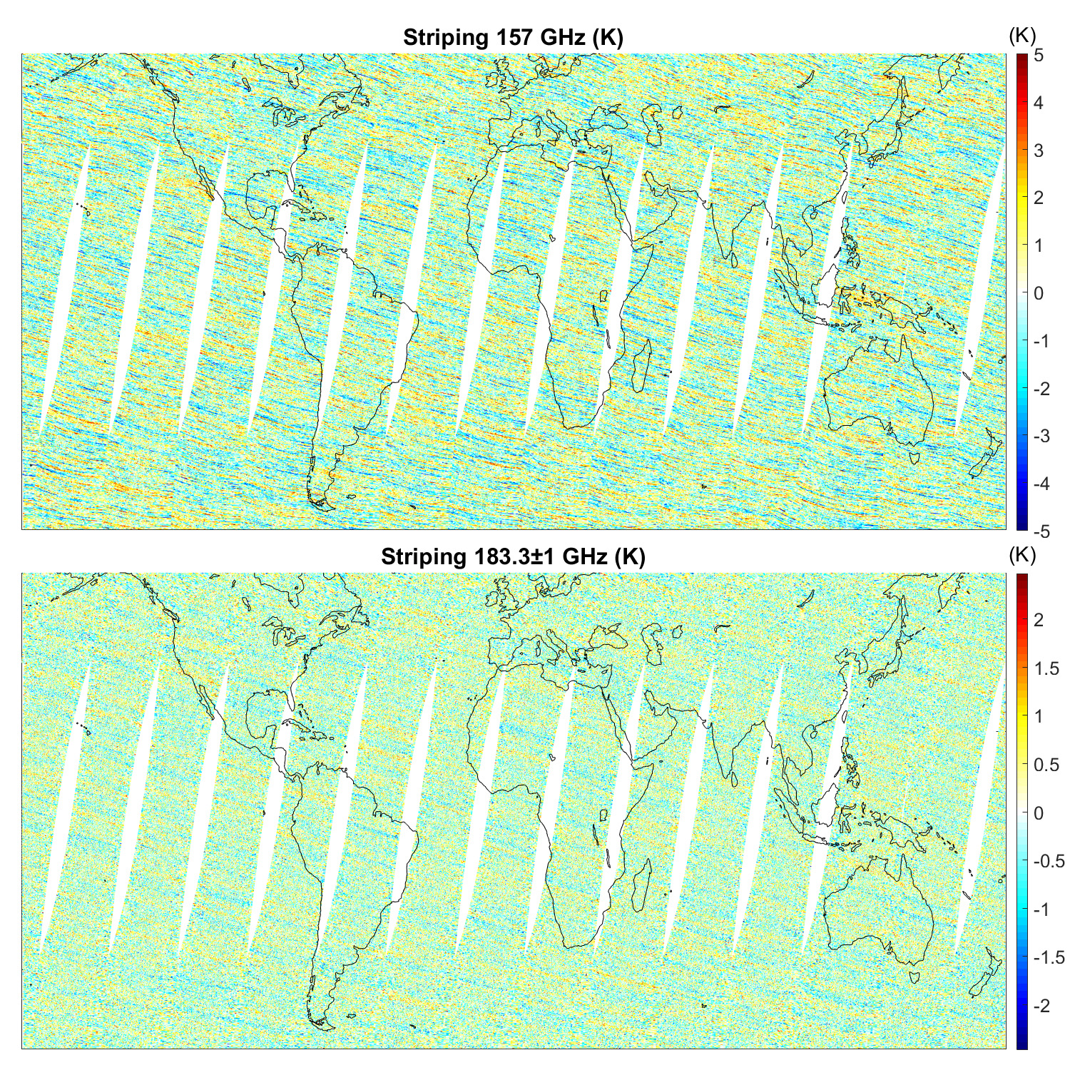
Striping of MetOp-A MHS on July 1, 2019

Quantifying and Characterizing Striping of Microwave Humidity Sounder With Observation and Simulation

ESSIC/CISESS scientists John Xun Yang, Yalei You, and Rachael Kroodsma are co-authors on a new paper in IEEE Transactions on Geoscience and Remote Sensing alongside Sidharth Misra from NASA Jet Propulsion Laboratory and William Blackwell from MIT Lincoln Laboratory. Blackwell is also a two-time speaker for the ESSIC Seminar Series, the most recent of which can be viewed here.

Read More »
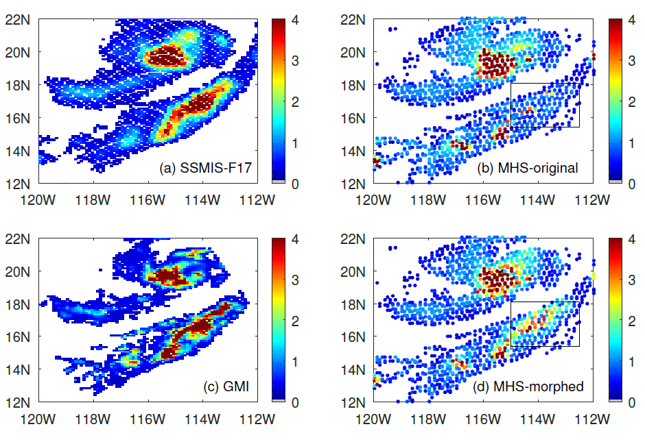
Figure: This is a precipitation event on 29 August 2020 over the Pacific Ocean near the lower California peninsula. (a) the cross-track radiometer precipitation data, (b) the conical scanning radiometer precipitation data, (c) the reference data for the event, and (d) the “morphed” radiometer precipitation data. The box shows the area of improvement due to morphing.

Improving Satellite Precipitation Retrieval

ESSIC/CISESS Scientists Yalei You, John Xun Yang, and Jun Dong have a new article on using “morphing” to improve rain data from cross-track scanning radiometers. The paper, titled “Improving Cross-track Scanning Radiometers’ Precipitation Retrieval over Ocean by Morphing”, is in press at the Journal of Hydrometeorology.

Read More »