")
Groundwater Recharge Estimated by Land Surface Models: An Evaluation in the Conterminous United States
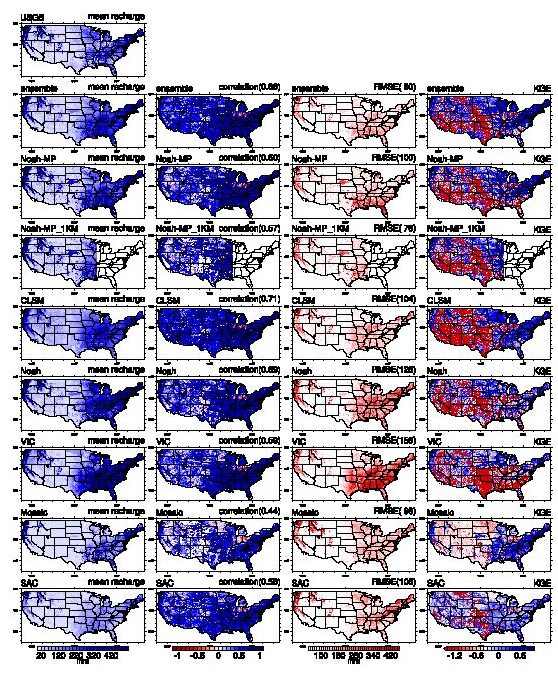
ESSIC/CISESS Assistant Research Scientists Bailing Li and Jessica M. Erlingis are authors of a paper in the Journal of Hydrometeorology titled “Groundwater Recharge Estimated by Land Surface Models: An Evaluation in the Conterminous United States”.