
Using Simple Models To Understand Hurricane Dynamics
Prof. Timothy Cronin Department of Earth, Atmospheric, and Planetary Sciences Massachusetts Institute of Technology Monday November 6, 2023, 2 PM ET Abstract: Hurricanes are
")
Prof. Timothy Cronin Department of Earth, Atmospheric, and Planetary Sciences Massachusetts Institute of Technology Monday November 6, 2023, 2 PM ET Abstract: Hurricanes are
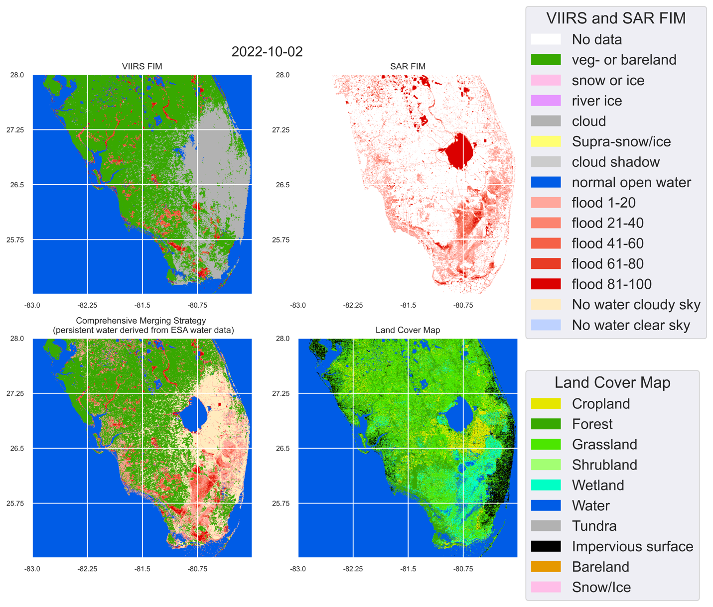
Hurricane Ian made landfall in Florida on the afternoon of 9/28/2022 as a massive Category 4 storm and brought record-setting winds. As of 10/4/2022, at least 105 people have been reported as casualties of Hurricane Ian, 55 of which in Lee County, Florida. Even more people are without power or their home. The NOAA STAR Flood team has produced VIIRS Flood maps, Sentinel-1 SAR Flood maps, and blended Flood maps to report the flood extent due to Hurricane Ian.
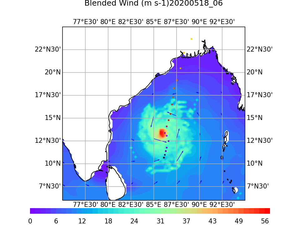
ESSIC/CISESS Scientist Korak Saha and collaborator Huai-min Zhang have been improving the NOAA/NCEI Blended Seawinds (NBS) product. NBS blends several satellite estimates of surface wind, providing more accurate and gap-free observational data for model calibration and quality control. NOAA has been producing a global gridded 0.25-degree and 6-hourly sea surface winds product that has wide applications in marine transportation, marine ecosystem and fisheries, offshore winds, weather and ocean forecasts, among others.
ESSIC/CISESS Associate Research Scientist Lin Lin has a new article in IEEE Transactions on Geoscience and Remote Sensing titled, “Associations of Hurricane Intensity Changes to Satellite Total Column Ozone Structural Changes Within Hurricanes”.
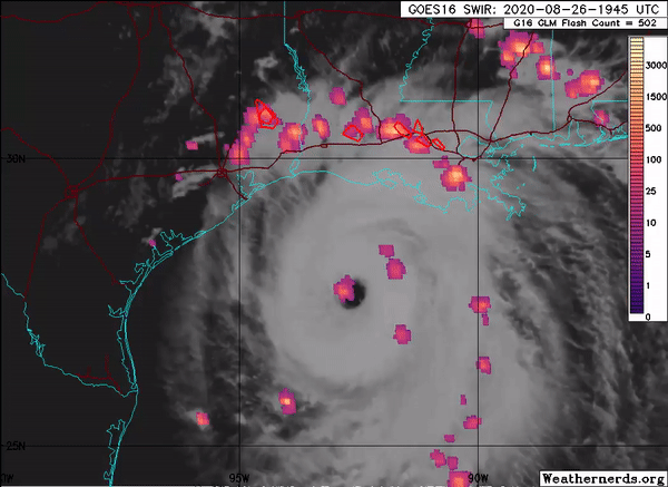
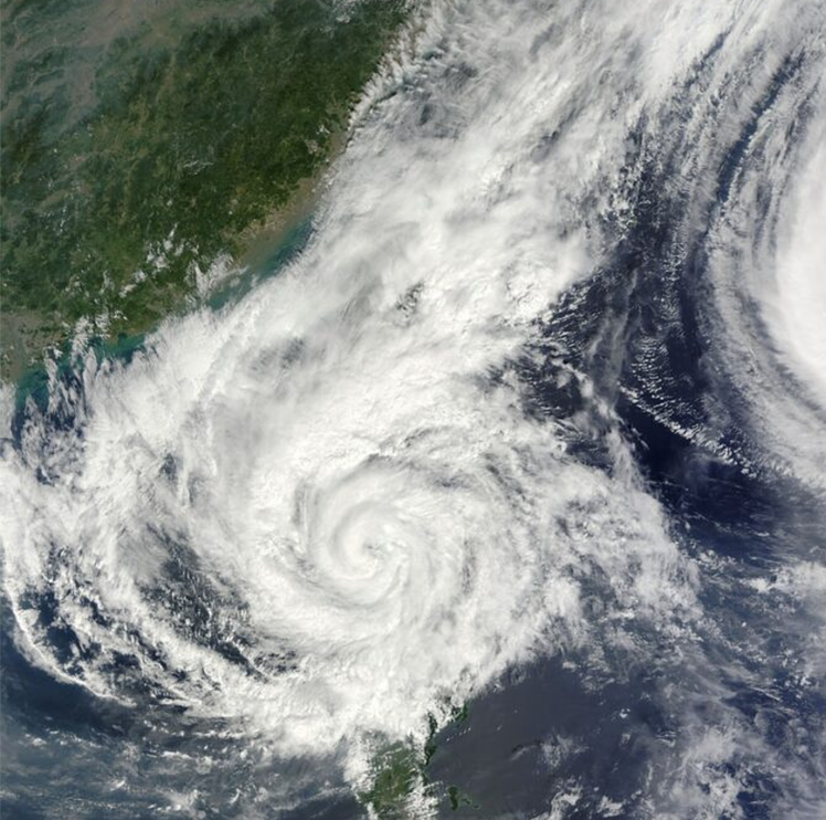
The Advanced Microwave Scanning Radiometer 2 (AMSR2) onboard the GCOM-W1 satellite captured Hurricane Laura, the deadly Category 4 hurricane that hit Louisiana in late August. AMSR2 is a remote sensing instrument used to measure weak microwave emission from Earth’s surface and atmosphere. SCSB- and CISESS-led products captured Hurricane Laura at various stages of development. Visiting Assistant Research Scientist Scott Rudlosky shared several images to his Twitter feed, which show considerable lightning around the eye wall during Laura’s intensification.
