Home » canopy

Tag: canopy

Figure. The 6 × 6 km2 Howland forest area in Maine: (A) the true color image obtained by the EO-1 Hyperion on March 5, 2014 (DOY 64) at a spatial resolution of 30 m; and maps of (B) snow cover fraction (SNOWCF); (C) surface water cover fraction (WaterBodyCF); (D)soil cover fraction (SOILCF); (E) vegetation cover fraction (VGCF); (F) fAPARcanopy; (G) fAPARchl; (H) fAPARnon-chl.

An Evergreen Forest Ecosystem from Satellites

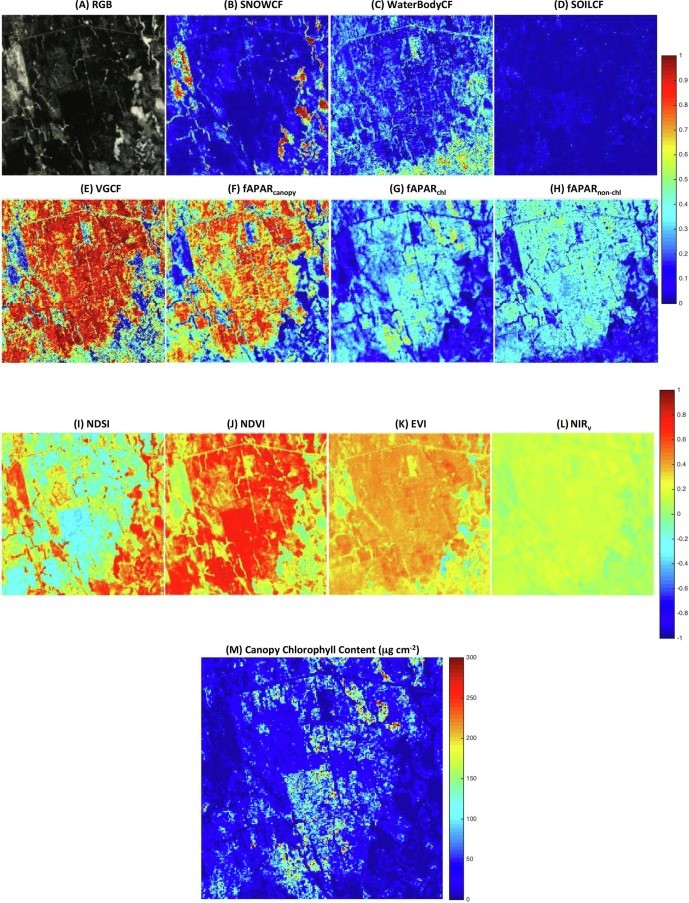
ESSIC/CISESS Scientist Qingyuan Zhang has a new article to be published in International Journal of Applied Earth Observation and Geoinformation that characterizes the seasonally snow-covered Howland boreal forest ecosystem in Maine, USA with satellite images.

Read More »