Shao, Uprety, and Wang Work With New Simulated METimage Radiance Data
Cazzy Medley
Highlights
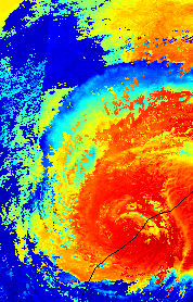
Figure: Examples showing the simulated Hurricane Florence on Sept. 15, 2018 for the 0.555 µm (visible)
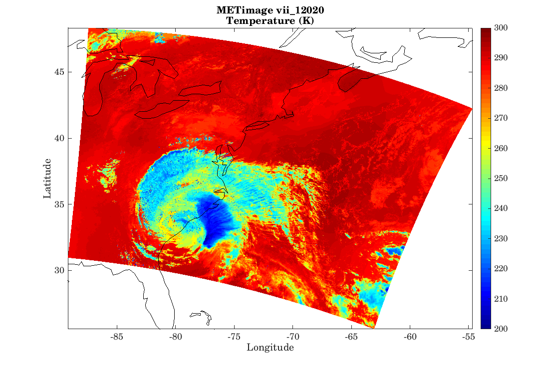
Figure: Example showing the simulated Hurricane Florence on Sept. 15, 2018 for 12.02 µm (thermal infrared) METimage channel.
Figure: Examples showing the simulated Hurricane Florence on Sept. 15, 2018 for the 0.555 µm (visible) and 12.02 µm (thermal infrared) METimage channels.
ESSIC/CISESS scientists Xi Shao, Sirish Uprety, and Wenhui Wang have been working with METImage, one of the major payloads on EUMETSAT Polar System Second Generation (EPS-SG), which is expected to be launched in 2023.
With 20 channels covering the visible, near-infrared, and infrared spectrum and 500 meter spatial resolution, METImage will be the primary imaging radiometer in the mid-morning orbit for the next decades, following on to the Advanced Very High Resolution Radiometer (AVHRR) on the Metop satellites.
To support the Level 2 algorithm and software development at NOAA, the scientists have developed a First Principle Physics-based Scene Simulation software to produce simulated METimage radiance data. The simulated METimage radiance data covers Hurricane Florence on Sept. 15, 2018 with three orbits of 11 visible/near-infrared channels during daytime and 9 infrared channels during day/night-time.
Xi Shao is an associate research scientist at ESSIC/CISESS and Department of Astronomy of University of Maryland. He supports radiometric calibration and validation work for Suomi-NPP and NOAA-20 Visible Infrared Imaging Radiometer Suite (VIIRS) instrument and METimage on EPS-SG. Sirish Uprety is an ESSIC/CISESS senior faculty specialist as well as a member of the NOAA STAR VIIRS calibration support team. He is primarily working on the post-launch calibration and validation of Suomi-NPP and NOAA-20 VIIRS. Wenhui Wang is a visiting associate research scientist at ESSIC/CISESS supporting calibration and validation of VIIRS onboard Suomi-NPP/NOAA-20 and METimage onboard EPS-SG.
")


