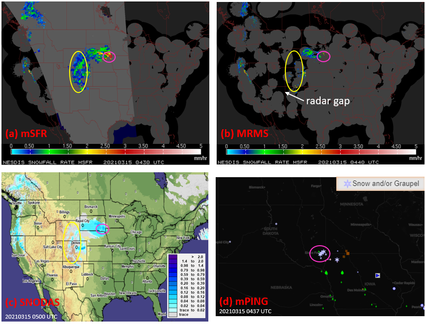
The figure shows the mSFR product (a) and the Multi-Radar Multi-Sensor (MRMS) instantaneous precipitation product (snowfall only) (b). The satellite snowfall rate product captures snowfall in many areas that is missed by the radar product mostly due to the lack of radar coverage (yellow oval). The mSFR derived snowfall area and intensity match well with the SNODAS hourly snowfall analysis (c). Figure 1(d) displays the corresponding mPING crowdsourcing weather reports. There are several reports of intense snowfall in the Sioux Falls, SD area (magenta oval) that is reflected in the mSFR and SNODAS images but missed by MRMS.
The ESSIC/CISESS scientists on this project are Visiting Research Scientist Huan Meng, Faculty Specialist Jun Dong, Associate Research Scientist Cezar Kongoli, Assistant Research Scientist Yongzhen Fan, and Visiting Associate Research Scientist Ralph Ferraro. The group also includes NOAA scientists Banghua Yan and Limin Zhao.

")


