")
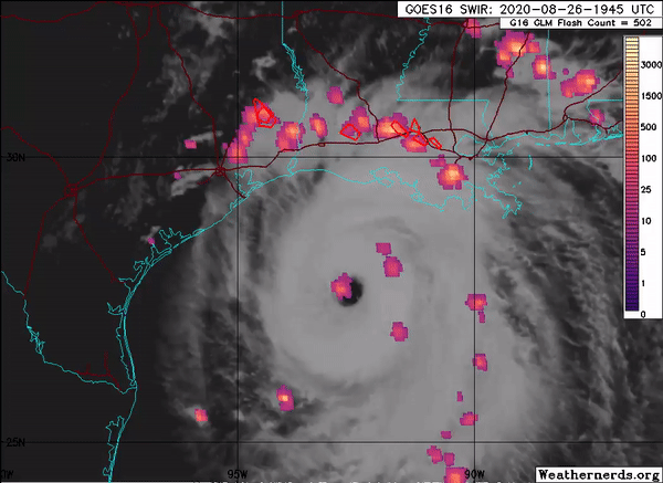
The Advanced Microwave Scanning Radiometer 2 (AMSR2) onboard the GCOM-W1 satellite captured Hurricane Laura, the deadly Category 4 hurricane that hit Louisiana in late August. AMSR2 is a remote sensing instrument used to measure weak microwave emission from Earth’s surface and atmosphere. SCSB- and CISESS-led products captured Hurricane Laura at various stages of development. Visiting Assistant Research Scientist Scott Rudlosky shared several images to his Twitter feed, which show considerable lightning around the eye wall during Laura’s intensification.
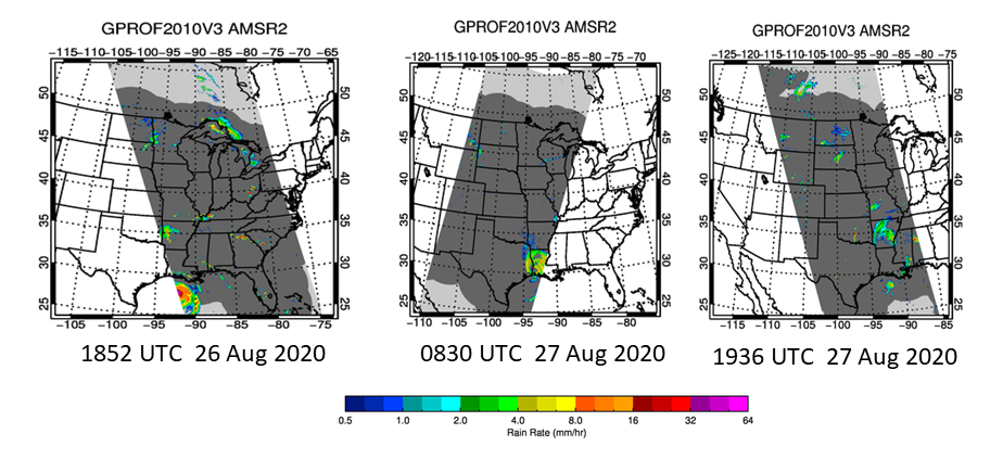
Figure 2 above is a sequence of rain rain products as Laura intensified and moved onshore, and then inland. The rain rates corresponded relatively well with in-situ data, although some of the banding features were missed. This will be improved upon with an updated algorithm being finalized at CISESS.
Scott Rudlosky is a SCSB/STAR/NESDIS/NOAA visiting associate research scientist working in collaboration with ESSIC/CISESS. He serves as a member of the GOES-R Risk Reduction Team that develops algorithms and datasets to better understand future operational applications of total lightning datasets that will be provided by the Geostationary Lightning Mapper (GLM) aboard the upcoming GOES-R satellite. This research focuses on the evaluation of ground- based lightning detection networks relative to satellite observations, and the development and evaluation of operational lightning products. As a member of the SCSB, Scott’s focus is broadening to include microwave precipitation observations and the detection of wildfires from space.


