")
Return to the North

March 2012 sees us busily preparing for our annual spring aircraft deployment to the Arctic, to re-survey key parts of the polar regions. NASA’s Operation IceBridge mission is an airborne survey dedicated to measuring the thickness of sea ice in the Arctic and Southern Oceans, as well as the ice mass-balance of the Greenland and Antarctic ice sheets. The IceBridge Mission bridges the gap between the ICESat satellite, which concluded its operations in late 2009, and the launch of the follow-on ICESat-2 Mission in 2016. IceBridge utilizes NASA aircraft that carry an array of remote sensing instruments including laser and radar altimeters, digital cameras, and a gravimeter to gather critical information about how ice in the Arctic and Antarctic is changing over time.
This spring, NASA plans to use up to three aircraft to map Arctic sea ice from mid-March to late April. We will survey specific regions of the ice pack that are observed to be in a state of rapid change to learn more about the current state of the ice and to better understand the factors driving such change. This year, we also hope to work with a number of our national and international colleagues who will be gathering complimentary data from other aircraft in the area, as well as in situ measurements of snow and ice thickness directly on the ice. The team of people involved in such a mission is large, so extraordinary attention to detail is required to be sure that our measurements are coordinated in time and geographical location to obtain the best overall dataset. Exchange of flight line plans, survey line locations, and satellite telephone numbers is a must! We look forward to busy few weeks ahead and a crucial new dataset, analysis of which will keep us on our toes for the rest of the year!
Dr. Sinead Louise Farrell is an Assistant Research Scientist at the Earth System Science Interdisciplinary Center (ESSIC). To learn more about her research, please go to: http://www.star.nesdis.noaa.gov/star/Farrell_S.php
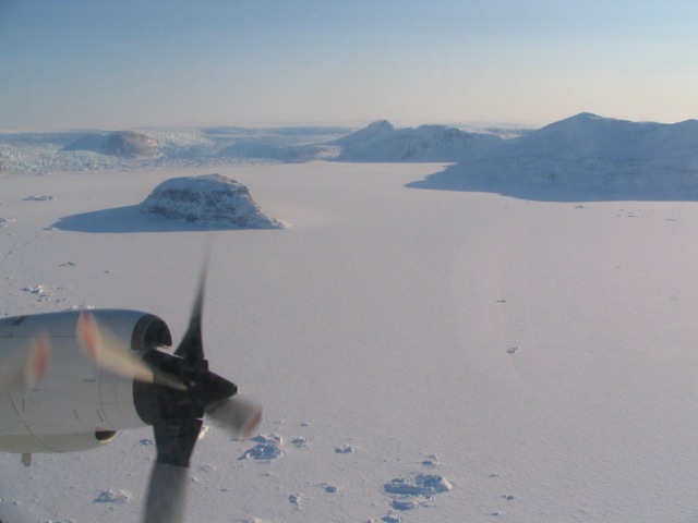
NASA P-3B aircraft maps Arctic ice during Operation IceBridge. Image Credit: S. Farrell


