Providing Observations When Radars Aren’t Available
Cazzy Medley
Highlights
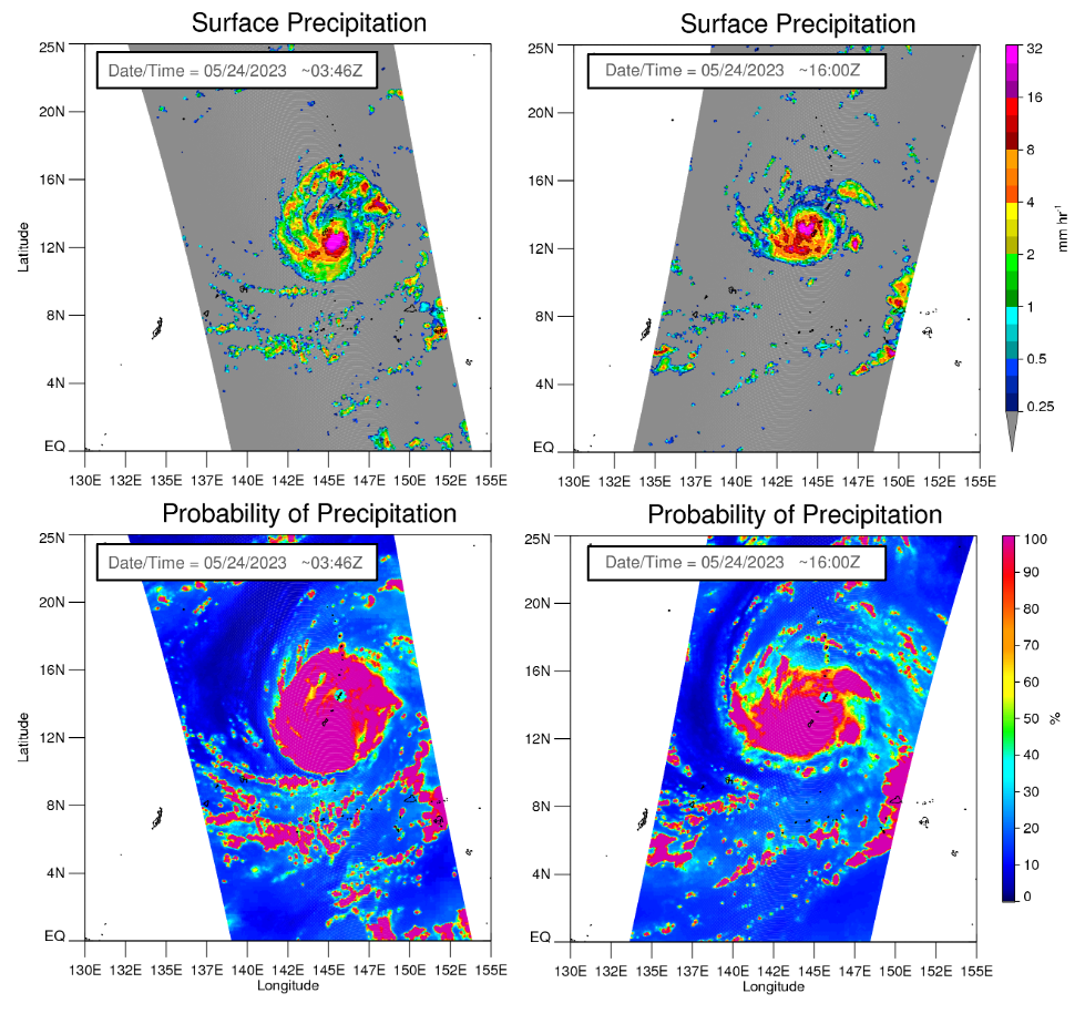
AMSR2 Precipitation Product During Mawar’s Landfall in Guam
Typhoon Mawar, a Category 4 storm, made landfall on Guam on May 24th. It brought mandatory evacuation, flash flooding, and rainfall rates of over 2 inches per hour to the island, totalling over 20 inches within 24 hours. It was deemed the strongest Northern Hemisphere tropical cyclone on record for the month of May.
The strong winds and power outages resulted in disruption of the National Weather Service (NWS) radar operation on Guam, forcing the forecasters to rely on satellite observations and Numerical Weather Prediction (NWP) products only. During this time, shortly before and soon after the hurricane’s landfall, Advanced Microwave Scanning Radiometer-2 (AMSR2) on board the satellite GCOM-W1 made two overpasses over the region, capturing the tropical system within its swath. AMSR2 precipitation retrieval, maintained by the ESSIC/CISESS science team (Veljko Petkovic, Malar Arulraj, Ralph Ferarro, and Huan Meng), delivered detailed and highly accurate estimates of the rainfall fields.
The figure below presents AMSR2 rainfall estimated at 03:46 and 16:00 UTC on May 24th.
Figure: GPROF AMSR2 rainfall estimates during hurricane Mawar, which made a landfall in Guam on May 24th 2023. (Top) rainfall rate; (bottom) probability of precipitation.

")


