NASA recently gathered information and created an animation of the nine tornadoes across Maryland earlier this month.
NASA’s Aqua Satellite gathered information on the power behind the severe weather that moved into Maryland on Friday, June 1. NASA then created an animation of the tornadoes as seen from NOAA’s GOES-13 satellite.
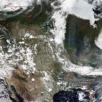
The Atmospheric Infrared Sounders (AIRS) instrument, which flies aboard NASA’s Aqua Satellite, provided a visible and infrared image of the severe weather, according to NASA.
The infrared imagery, which captured data on temperature and cloud heights, showed that the major activity of the severe weather was located in West Virginia, with parts headed toward Maryland. As seen with from the GOES viewpoint, the surface action is covered by cloud tops.
The animation created by the GOES imagery runs about eight seconds and shows the movement of the severe storms from 1:45 p.m. to 7:45 p.m.
According to NASA, “The colorized full resolution uses the GOES visible data of the clouds, overlaid on a U.S. map created by imagery from the Moderate Resolution Spectroradiometer instrument (MODIS), an instrument that flies onboard both the NASA Aqua and Terra satellites.”


