")
NASA Operation IceBridge: Notes from the Field (Arctic 2013)

Introduction:
The NASA Operation IceBridge mission began the Arctic 2013 research campaign on Monday 20th March. The mission will survey the Greenland Ice Sheet and sea ice pack of the Arctic Ocean. The NASA IceBridge mission is now in its fifth year and continues to measure Arctic sea ice thickness and snow depth. These data continue the time series of ice thickness measurements begun with NASA’s ICESat in 2003, and will provide a link to the NASA ICESat-2 mission, due for launch in mid-2016.
Surveys are conducted using a specially-equipped P-3B research aircraft (see photo below) that flies above the ice carrying a number of science instruments including radar and laser altimeters, and high-resolution cameras. This year the first flight took place from Thule, Greenland over Arctic sea ice north of the Lincoln Sea, on Wednesday 20th March. IceBridge flew beneath the European Space Agency’s CryoSat-2 satellite, that carries a special radar altimeter known as SIRAL. The mission was designed to fly a gridded-survey beneath the satellite to help validate CryoSat’s measurements over sea ice. The aircraft then transited from Thule across the Arctic Ocean to Alaska on Thursday 21st March. Over the coming days IceBridge will attempt a number of sea ice flights over the Beaufort and Chukchi Seas from a base at Fairbanks International Airport, Alaska. ESSIC’s Sinead Farrell hopes to participate in the first Alaska mission on Friday 22nd March, pending good weather. Dr. Farrell is a sea ice scientist and member of the NASA IceBridge science team.
Daily Blog Posts:
Tuesday 19th March: Arrived in Fairbanks, Alaska on Tuesday to slightly warmer spring temperatures than I had expected. After organizing a rental car, figuring out how to use the engine heating block and the all-wheel drive, I headed for the hotel to unpack and (re)familiarize myself with the locale. The last time I enjoyed an extended visit to Fairbanks was exactly ten years ago, while I was conducting my graduate studies at University College London. Back then I also participated in a NASA airborne campaign over the Chukchi, Beaufort and Bering Seas aimed at validating the NASA AMSR-E radiometer. Things have not changed much in Fairbanks over the years!
Wednesday 20th March: The first in a series of IceBridge science flights was successfully completed on Wednesday. Although the mission was conducted far away over Arctic sea ice northwest of Greenland it was nonetheless a very exciting mission to follow. I was involved in designing a set of gridded flight-lines over the ice such that our airborne survey would provide temporally and spatially coincident measurements with CryoSat-2, while it passed high over-head. This is a technically challenging flight to conduct but things worked out well. The sea ice appeared more dynamic than we had expected, but the number of cracks in the ice, known as “leads”, will actually help in the data analysis aimed at inferring sea ice thickness. While waiting for the IceBridge mission to transit from Greenland to Alaska, I will spend time visiting the International Arctic Research Center (IARC), at the University of Alaska – Fairbanks (UAF). On Wednesday I had the opportunity to meet with some of my colleagues at IARC to discuss on-going and future projects to better understand the diminishing Arctic sea ice pack. I was also able to attend a lecture by Dr. Ron Kwok of NASA’s Jet Propulsion Laboratory on the topic of “Recent Changes in the Arctic Sea Ice Cover: A remote sensing perspective”. Fortuitously there are many national and international sea ice scientists visiting UAF right now to participate in meetings and workshops. Some are even en route to conduct field-work on the sea ice near Barrow, Alaska. Although it’s very cold (-19 degrees Celsius this morning!) and snowing, this is a great time of the year to be in Fairbanks!
Thursday 21st March: Thursday began with the exciting news that the NASA P-3 was en route to Fairbanks. Today’s mission from Greenland to Alaska was flown along what is called the “Laxon Line”. The flight is named in honor of University College London Professor Seymour Laxon. Seymour, my graduate advisor, died tragically 3 months ago. Seymour was a pioneer in the use of satellite altimeters to study sea ice and was the lead sea ice scientist on the CryoSat-2 mission. Today we measured ice thickness and snow depth along a flight line that crosses most of the Arctic Ocean. Thanks to a good tail-wind the P-3 landed one hour early in Fairbanks, right around lunch time. I was really lucky to watch the plane land with my colleagues Jackie Richter-Menge from the Cold Regions Research and Engineering Laboratory (CRREL) and Pam Posey from the Naval Research Laboratory (NRL). Once through customs we met our colleagues off the plane and welcomed them to snowy Alaska! On Friday we hope to conduct a third sea ice mission over the Arctic, weather permitting. We always need good weather to fly our surveys since clouds can potentially interrupt the measurements we make from the aircraft. We’re particularly interested to see what is happening to the sea ice in the Southern Beaufort Sea this year after the ice pack suffered a wide-spread “break out” event in mid-February. This event caused the ice pack to fragment into smaller floes and become more dynamic. Although these break-out events are not unusual in this region, they do not normally happen in February, the dead of winter. We will provide more updates as the day progresses.
Friday 22nd March: An early start this morning, we were up before dawn to prepare for the early-morning safety briefing and aircraft walkthrough. We were lucky with the weather today and things look good for a flight called the “Sea Ice – Beaufort-Chukchi Diamond”. Take off this morning was at 08:00 and we proceeded to the north Alaskan coast and out over the southern Beaufort Sea. During today’s flight we were interested to see how the ice break-out event in mid-February affected the sea ice cover. We saw lots of expansive regions of very thin ice (leads that had opened up during the break out event had since become covered with thin ice due to regrowth in the extremely cold Arctic air). We were surprised to see very little old, multi-year ice, instead the survey mainly consisted of seasonal ice less than one year old. Our survey line was interspersed with some thin clouds, fog and haze at times, which was to be expected, but overall a very successful mission was completed. We landed back in Fairbanks at 16:00 local time.. and time for early dinner. We will try to do this all again tomorrow!
Saturday 23rd March: Wea
ther is looking good today for a flight in the eastern Beaufort Sea. We are keen to compare the ice in today’s survey area with what we saw yesterday in the western Beaufort and Chukchi Seas. Early morning call again, and we woke to light snow and about 1-2 inches of accumulation overnight. Luckily the snow here in Fairbanks is dry, light and fluffy so it doesn’t take long to “dig out” the car!
We had a very successful flight today in the eastern sector of the Beaufort Sea. Weather conditions today were perfect and we did not encounter any clouds during the survey. We were pleased to find wide expanses of multi-year sea ice in the survey area today, in contrast to yesterday’s flight which was mainly over seasonal (or first-year) ice. We had a busy day as there was a film crew onboard. Since we encountered many instances of changing ice type today we had to keep a constant look out. Overall another great day flying the NASA P-3.
Sunday 24th March: Another early morning call today and we’re headed out on the “Sea Ice – SIZRS” flight today north of Barrow, AK. It’s a cold morning here, just about -22’C, but the crisp air is great for waking us up!
Just back from the final in a set of three NASA/IceBridge flights over the Arctic to be flown out of Fairbanks, AK. Another really great day of data collection and beautiful sea ice. Our survey was mainly over seasonal sea ice again, but as we transitioned north across the 74 degrees line of latitude we did encounter some thinker, multi-year ice floes. These floes likely entered the Beaufort Gyre further east in the Canada Basin and were circulated around to the northern Beaufort during the winter. Based on last year’s data we also expected to find some thicker ice close to the coasts of Alaska and Canada in the southern Beaufort Sea. What we found were large expanses of consolidated sea ice and rubble fields, that had been heavily deformed presumably due to ice forcing towards the coast line. We were joined on the P-3 by a film crew from Showtime for the last two days who were keen to film the sea ice and interview the team. The icing on the cake for the day though was a sighting of a polar bear from one of the aircraft windows. I was amazed how big and “yellow” the bear looked compared to the sea ice. It was wonderful to see such a beautiful and enigmatic creature in its natural habitat.
Monday 25th March: It is a “hard down” day today for the IceBridge flight crew and team. This means that some people have the day off to catch up on some R&R. However most will be working hard doing on data processing, report writing or maybe even blogging! Today I am back at the International Arctic Research Center at UAF to continue visiting with colleagues here including Dr. Jenny Hutchings who is one of my collaborators. We received a few inches of snow overnight last night, so it’s a real winter wonderland here, much like it must be in Washington DC right now!
Tuesday 26th March:The NASA P-3 departed Fairbanks during the night and made a safe transit across the Arctic to Thule, Greenland. The team need to depart during the night in Alaska in order to land back in Thule before that airport closes at 4 pm local time. This also takes into account the five hour time difference between the two locations! Although there was a forecast for auroral activity last night we unfortunately did not see the Northern Lights. With one science team away the next set of sea ice scientists arrived in town. I was fortunate to bump into my colleagues from the Alfred Wegener Institute (AWI) in Germany who are in Fairbanks for a few days. They will fly to Barrow, Alaska tomorrow afternoon to continue the ongoing sea ice surveys being conducted there. Today I am visiting colleagues at the Geophysical Institute at UAF. The overnight temperatures were quite low last night, so the roads were a little icier this morning than before. They have the art of clearing snow down to a fine art though so everyone can get on with business as usual. No snow days here!
Wednesday 27th March: With the NASA P-3 back in Thule, Greenland, an IceBridge mission over the sea ice north and east of the Greenland coast was conducted today. The mission, called “Zigzag East Nares Strait”, consists of a pattern of zig-zag flight lines north of Greenland designed to measure some of thickest sea ice in the Arctic. These data will provide a very interesting comparison to the data we collected in the Chukchi and Beaufort Seas, where the ice is typically thinner. En route to this thick ice, the P-3 transited north through the Nares Strait to collect sea ice measurements in support of research being conducted at the Canadian Space Agency. After an extremely busy week in Fairbanks, I too am traveling back home to Washington, DC. It’s a long flight, with some delays and lost luggage. It is great to be home, but I’m missing the snow and sea ice already!
Thursday 28th March: We’ve had a very successful campaign over the Arctic so far this March, with a set of seven sea ice flights conducted over a range of ice types. Together the data from these missions will help us to understand the current state of the ice pack. We will combine information from the various science instruments flown on the P-3 to derive estimates of ice thickness. The main instruments used during the sea ice missions are the Digital Mapping System (a digital camera), the Airborne Topographic Mapper (an airborne lidar), the CRESIS Snow Radar (an FMCW radar system), the University of Kansas KU-band radar, and a KT-19 radiometer used to measure surface temperature. Data disks will be sent via express mail to a team at the NASA Goddard Space Flight Center who will immediately begin processing and analyzing the measurements. We hope to have some of the first estimates of Arctic sea ice thickness within the coming month. These “quick look” estimates will be compared with data from the previous four years to assess the overall health of the ice pack. Once the P-3 undergoes some maintenance over the weekend, the team will begin to collect measurements over the Greenland Ice Sheet. These data will be used to measure ice mass loss and better understand the contributions of the Greenland Ice Sheet to sea level rise. Weather permitting we hope to conduct a few more sea ice missions later in the month of April.
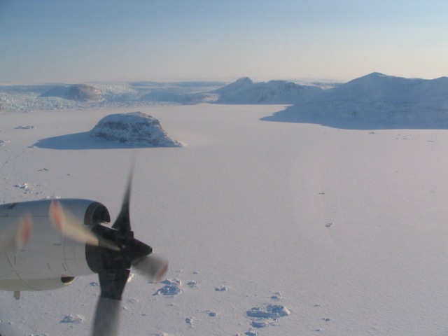
NASA P-3 (Credit: S.Farrell)


