")
Multi-Scale Observations Preceding the Moore, OK Tornado
By: Scott Rudlosky
With contributions from Patrick Meyers (CICS-MD/ESSIC)
Extreme weather events such as the recent Oklahoma tornados consistently remind weather and climate scientists of the importance of their work. Fortunately, the United States has a dense network of observing systems coupled with a dedicated group of researchers and forecasters who use these systems to better understand, predict, and analyze these dangerous natural forces. Collaborations between physical and social scientists have helped provide the National Weather Service (NWS) and general public with tools and information that save many lives during these inevitable natural events.
Weather observing systems generally fit in two categories: in-situ sensors that directly monitor their surrounding environment and remote sensing instruments that observe the environment from a distance. Researchers and forecasters use these observations to both visualize weather as it occurs and improve model predictions of future weather. This article describes observations immediately preceding the May 20, 2013 tornado in Moore, OK to illustrate some of the different scales at which this event was observed, and also to introduce an ongoing project at the Cooperative Institute for Climate and Satellites – Maryland (CICS-MD) and Earth System Science Interdisciplinary Center (ESSIC).
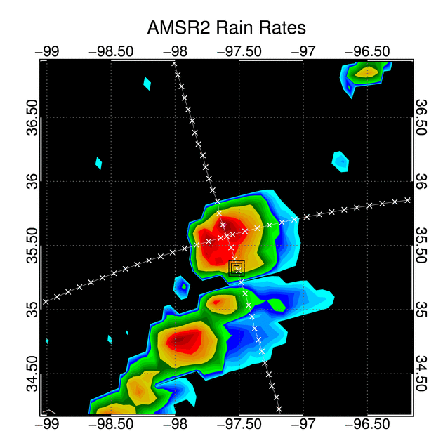
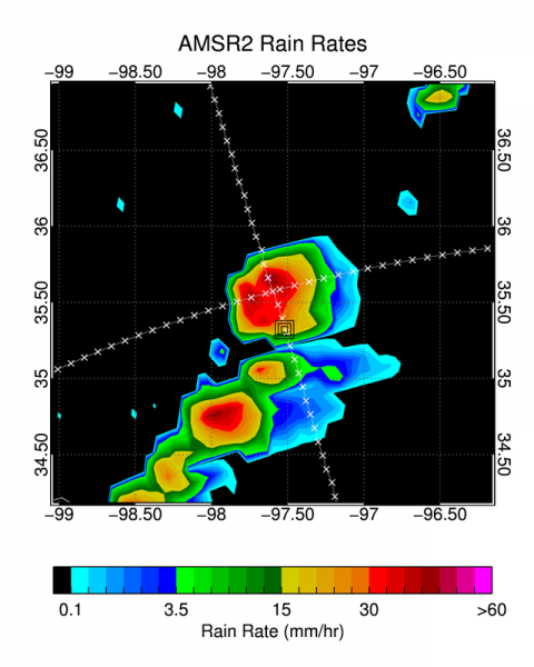
The illustration above displays observations from a polar-orbiting satellite (AMSR2), geostationary satellite (GOES), and ground-based radar (NMQ) approximately 15 minutes before the Moore, OK tornado. These images display products derived from raw satellite, radar, and in-situ observations. Each sensor measures the atmosphere differently, with advantages and disadvantages that must be understood to produce high quality products for forecasters, researchers, and emergency managers.
Much research went into the development of these products, and each has specific operational and research applications. These applications depend on the scale of the observations, which in turn largely depend on the distance between the observation and sensor. The GOES imagery is obtained from a distance of ~35,000 km (~22,000 miles), the AMSR2 data from ~700 km (~430 miles), and the radar imagery from less than 30 km (20 miles). By combining observations from multiple platforms, scientists seek to improve algorithm performance and expand applicability.
GCOM AMSR2 Rain Rate Retrieval Project
The Global Change Observation (GCOM) satellite observed the Oklahoma region approximately 15 minutes prior to the touchdown of the EF-5 tornado in Moore, OK. Launched in May 2012, GCOM is a joint venture between NOAA and the Japanese Aerospace Exploration Agency as part of the Joint Polar Satellite System (JPSS) program. The Advanced Microwave Scanning Radiometer 2 (AMSR2) aboard GCOM is used to calculate brightness temperatures that are ingested into the GPROF2010, a rain rate retrieval algorithm developed by ESSIC/CICS-MD scientists.
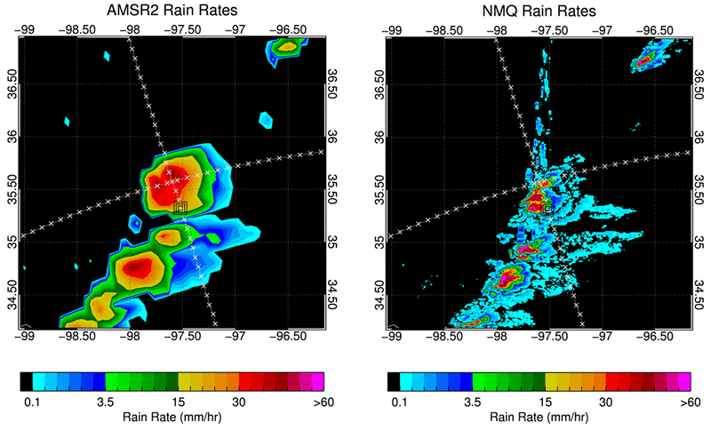
Despite their differing spatial resolution, the image above reveals that the GPROF2010 rain rate estimates are similar to those reported by the radar-based National Mosaic and Multi-Sensor QPE (NMQ). The quantitative similarities with NMQ are encouraging because NMQ combines radar and in-situ observations to provide the most accurate rain rate verification data presently available throughout the U.S. In addition to developing new products, CICS-MD also hosts a Calibration and Validation Center that works to evaluate satellite rainfall retrievals using NMQ and other related data sets.
Cross sections through this tornadic storm (not shown) were used to evaluate the brightness temperature response. Extremely low brightness temperatures (at 36 and 89 GHz) were observed, indicating the presence of ice-induced scattering associated with hail in the core of the storm. Brightness temperature polarization differences also revealed an east/west gradient at lower frequencies (7 and 10 GHz), with larger values to the west indicating greater soil moisture caused by precipitation from the storm.
The NWS forecasters issued a tornado warning approximately 15 minutes before touchdown of the Moore, OK tornado. Unfortunately, data from polar-orbiting satellites cannot be used for short-term nowcasting, since these data cannot be transmitted, processed, and disseminated quickly enough to benefit forecasters during these rapidly evolving storms.
However, polar-orbiting satellites do provide valuable global input into Numerical Weather Prediction forecasting models. Furthermore, polar orbiters cover regions where surface observations are sparse, such as over oceans and much of the Eastern Hemisphere, providing data that can be used for climate and drought monitoring. This example shows the importance of these complementary datasets, and illustrates why scientists strive to better understand relationships between them.


