Monitoring California Flooding Using VIIRS and Sentinel-1
Cazzy Medley
Highlights
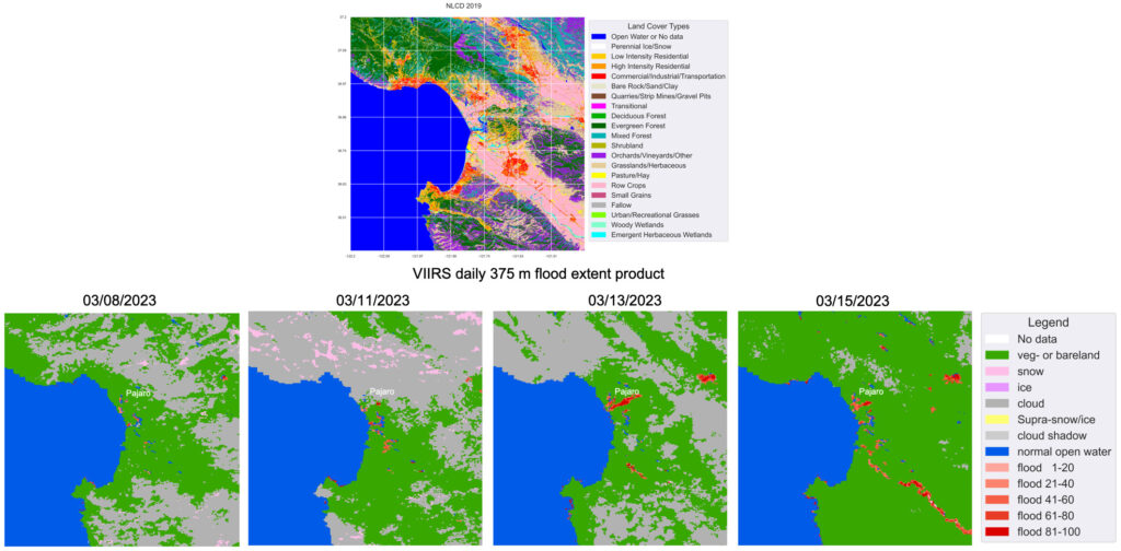
ESSIC Associate Research Scientist Qingyuan Zhang recently used VIIRS daily 375m flood extent products on 3/8/2023, 3/11/2023, 3/13/2023 and 3/15/2023 to monitor flooding in California.
Starting in late December, California endured intense atmospheric rivers and received high levels of rainfall and snow. Major flooding has been occuring along major rivers. The winter storms have stressed the state’s infrastructure, including 1,500+ dams and ~14,000 miles of levees, since December. More than a dozen levee breaches have flooded roads and inundated homes along the Cosumnes River near Sacramento during storms around New Year’s Day. Communities there are still recovering. California levee failures mount as floods continue their relentless drive. Pajaro is suffering from a levee break.
The following figure shows a National Land Cover Database (NLCD) map around Pajaro, a community currently suffering from a levee break. The 74-year-old earthen Pajaro levee worked on 3/8/2023 as the VIIRS daily 375 m products indicated. It rained again on Friday night, 3/10/2023. Flooding due to the Pajaro levee break was captured by the VIIRS daily product on Saturday, 3/11/2023. The Pajaro river flooded freeways and farms, and forced many residents to flee. This flooding continued on 3/13, then receded on 3/15 (Figure 1).
Figure 1. Using VIIRS daily 375 m flood extent products on 3/8/2023, 3/11/2023, 3/13/2023 and 3/15/2023 to monitor flooding in California. Top figure shows the NLCD map in 2019 for an example area. Bottom figures are VIIRS daily products.
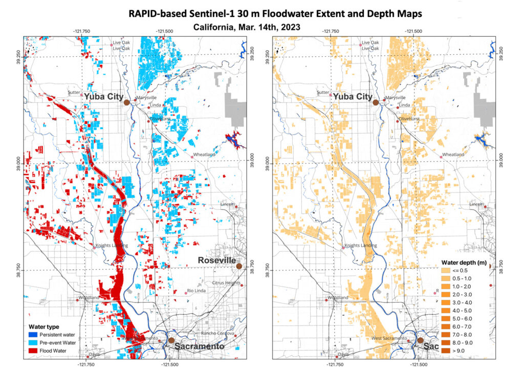
The VIIRS daily flood product on 3/15 also shows the Salinas River and the San Joaquin river, which both flooded as well. CISESS Scientist Qingyuan Zhang has also collaborated with UWM’s Qing Yang and Xinyi Shen and NOAA’s Sean Helfrich to produce Sentinel-1 SAR flood extent and depth products. Figure 2 shows a pair of the floodwater extent and depth map products around Yuba City to Sacramento, California on 3/14/2023.
Figure 2. The RAPID-based Sentinel-1 30 m floodwater extent and depth maps for an area in California on 03/14/2023.
")


