Cezar Kongoli, ESSIC/CISESS associate research scientist, Tom Smith, ESSIC/CISESS visiting research scientist, have a new paper in Frontiers in Earth Science titled “Modeling and estimation of snow depth spatial correlation structure from observations over North America”.
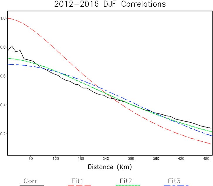
Estimation of spatial correlations should be an integral part of objective analysis of geophysical variables. However, a statistical assessment of spatial correlations has been given minimal attention in studies of snow depth analysis since they began over 2 decades ago. To remedy this, Kongoli and Smith show a method for computing regional spatial correlations of observed snow depth and the daily snow depth increment as well as fitting them to correlation functions to estimate the correlation scale parameters.
Their results indicate potential utility for operational snow analysis. The assessment suggests a larger horizontal e-folding correlation scale than had been assumed in earlier studies, for both the snow depth and the daily increment. Using the larger scales can potentially improve analyses in poorly monitored areas with relatively flat topography. Over mountainous terrain, vertical e-folding correlation scales for observed snow depth is much smaller than that for the daily snow depth increment and for the snow depth increment used in operational snow analyses. This indicates that optimal interpolation-based analysis of the increments may be more accurate than the interpolation of snow depth data.
Kongoli’s research focuses on satellite hydrometeorology, cold regions hydrology and data assimilation. He is also an affiliate scientist at NOAA/NESDIS and an adjunct professorial lecturer at American University.
Smith is a physical scientist working in analyses that include both satellite and in situ data, and has been with NOAA for over 30 years. He has contributed to climate analyses of surface temperature and precipitation used for evaluating historical climate variations.
To access the article, click here: “Modeling and estimation of snow depth spatial correlation structure from observations over North America”.


