Innovative Use of Satellite Data Establishes Water Clarity Improvement at Restored Oyster Reefs
Cazzy Medley
Highlights
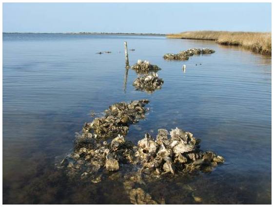
An example of an oyster reef. This one was artificially built parallel to the shoreline as a natural way to slow the rate of erosion by catching the wave energy. Credit: USFWS
Ron Vogel, ESSIC senior faculty specialist, recently co-authored a NOAA Technical Memorandum with colleagues from NOAA’s National Marine Fisheries Service, titled “Using Satellite-Derived Total Suspended Matter Data to Evaluate the Impacts of Tributary-Scale Oyster Restoration on Water Clarity.” In the study, the team sought to explore whether large-scale oyster restoration in the Chesapeake Bay, on the order of 100s of acres, can produce improvements in water clarity that are measurable, and whether satellites can be a tool to help measure that change.
Because oysters are filter feeders, they remove particles from the water as they eat, potentially leading to clearer water. Using long-term measurements of total suspended matter concentration (TSM), along with oyster biomass and submerged aquatic vegetation coverage, the team found that the satellite data helped to identify trends, and that there was a correlation between the most mature oyster reefs and decreased TSM over time. In-water studies have measured clearer water over restored reefs, but using satellites was a new method. The team is using this innovative technique to demonstrate the societal benefits from NOAA’s investments in both habitat restoration and satellite missions. This work is part of the multi-agency, multi-organization Chesapeake Bay Program partnership, working to restore a healthy Chesapeake Bay.
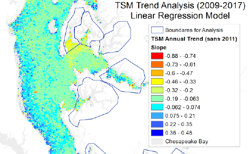
Temporal trend in TSM, represented spatially, shows highest negative slope (decreasing rate of change in TSM over time) in areas of most mature restored oyster reefs in the central portion of Chesapeake Bay.
In his research, Vogel applies earth-observation satellite data to environmental decision-making. He currently develops decision-support tools for water quality, fisheries and climate change in coastal areas. Other interests include ecological modeling with satellite data and vegetation and land surface monitoring by satellite. He has expertise in both visible and infrared satellite remote sensing.
")


