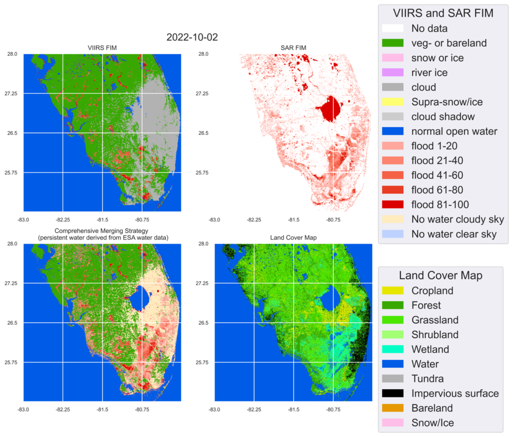
Figure: The VIIRS Flood map, Sentinel-1 SAR Flood map, and the comprehensively blended Flood map on 10/2/2022 reporting flood extent due to Hurricane Ian.
Hurricane Ian made landfall in Florida on the afternoon of 9/28/2022 as a massive Category 4 storm and brought record-setting winds. As of 10/4/2022, at least 105 people have been reported as casualties of Hurricane Ian, 55 of which in Lee County, Florida. Even more people are without power or their home. The NOAA STAR Flood team has produced VIIRS Flood maps, Sentinel-1 SAR Flood maps, and blended Flood maps to report the flood extent due to Hurricane Ian.
ESSIC/CISESS Scientist Qingyuan Zhang has collaborated with NOAA’s Sean Helfrich, University of Wisconsin-Milwaukee’s Qing Yang and Xinyi Shen, and George Mason University’s Sanmei Li to explore and document the impacts due to Hurricane Ian. The figure below shows the VIIRS flood map, Sentinel-1 SAR flood map and the comprehensively blended flood map on 10/2/2022 reporting flood extent.

")


