")
Monitoring human activity from space with satellite imagery and computer vision
This event has passed. See the seminar recording here:
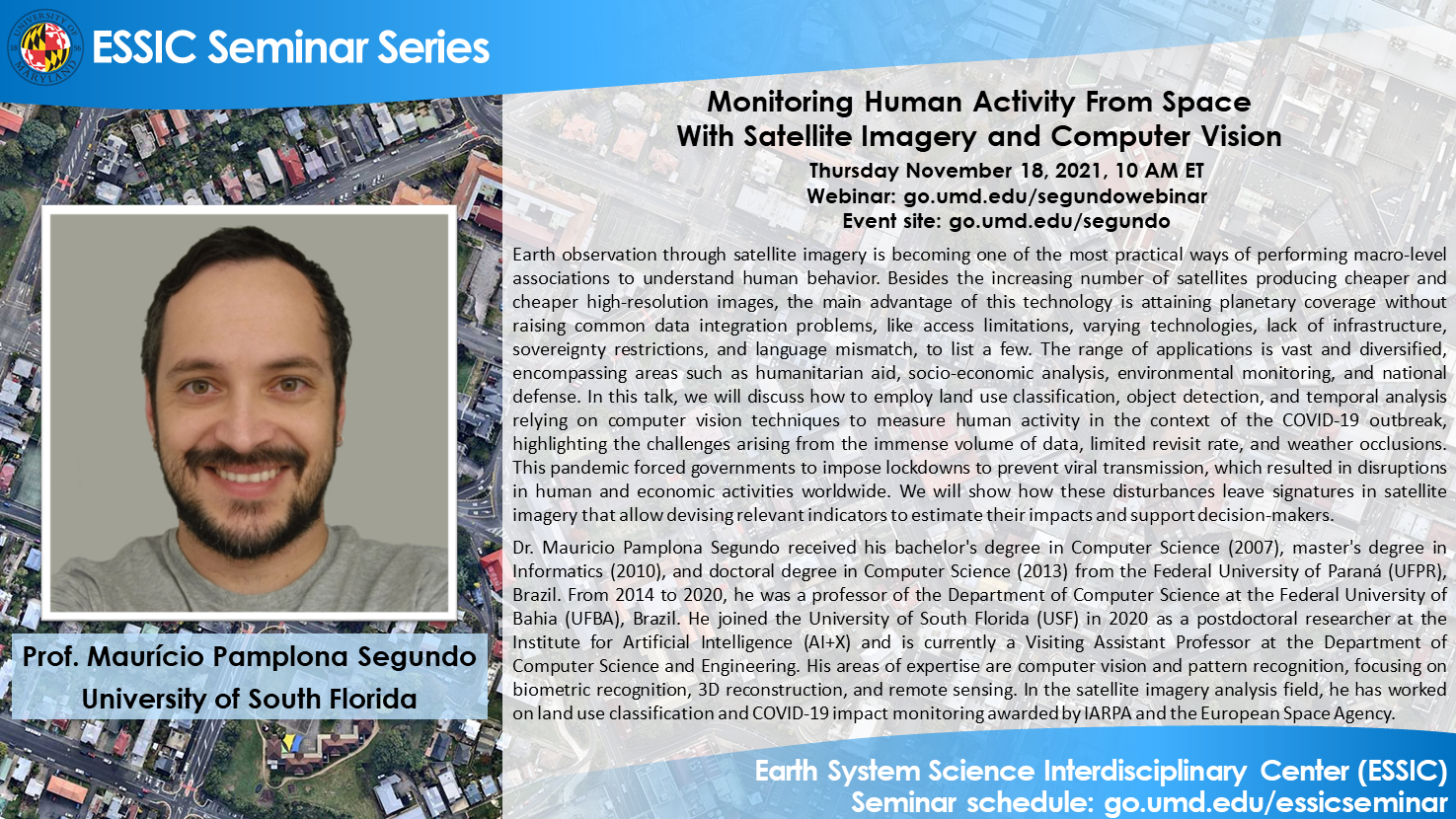
Prof. Maurício Pamplona Segundo
University of South Florida
Thursday November 18, 2021, 10 AM ET
Abstract:
Earth observation through satellite imagery is becoming one of the most practical ways of performing macro-level associations to understand human behavior. Besides the increasing number of satellites producing cheaper and cheaper high-resolution images, the main advantage of this technology is attaining planetary coverage without raising common data integration problems, like access limitations, varying technologies, lack of infrastructure, sovereignty restrictions, and language mismatch, to list a few. The range of applications is vast and diversified, encompassing areas such as humanitarian aid, socio-economic analysis, environmental monitoring, and national defense. In this talk, we will discuss how to employ land use classification, object detection, and temporal analysis relying on computer vision techniques to measure human activity in the context of the COVID-19 outbreak, highlighting the challenges arising from the immense volume of data, limited revisit rate, and weather occlusions. This pandemic forced governments to impose lockdowns to prevent viral transmission, which resulted in disruptions in human and economic activities worldwide. We will show how these disturbances leave signatures in satellite imagery that allow devising relevant indicators to estimate their impacts and support decision-makers.
Biosketch:
Dr. Mauricio Pamplona Segundo received his bachelor’s degree in Computer Science (2007), master’s degree in Informatics (2010), and doctoral degree in Computer Science (2013) from the Federal University of Paraná (UFPR), Brazil. From 2014 to 2020, he was a professor of the Department of Computer Science at the Federal University of Bahia (UFBA), Brazil. He joined the University of South Florida (USF) in 2020 as a postdoctoral researcher at the Institute for Artificial Intelligence (AI X) and is currently a Visiting Assistant Professor at the Department of Computer Science and Engineering. His areas of expertise are computer vision and pattern recognition, focusing on biometric recognition, 3D reconstruction, and remote sensing. In the satellite imagery analysis field, he has worked on land use classification and COVID-19 impact monitoring awarded by IARPA and the European Space Agency.
Webinar:
Webinar: https://go.umd.edu/segundowebinar
Event site: https://go.umd.edu/segundo
Webinar number: 2623 069 2836
Webinar password: essic
To join the audio conference only:
US Toll: 1-415-655-0002
Global call-in numbers
For IT assistance:
Cazzy Medley: cazzy@umd.edu
Resources:
Seminar schedule & archive: https://go.umd.edu/essicseminar
Seminar Google calendar: https://go.umd.edu/essicseminarcalendar
Seminar recordings on Youtube: https://www.youtube.com/user/ESSICUMD
