Figure: The VIIRS Flood map, Sentinel-1 SAR Flood map, and the comprehensively blended Flood map on 10/2/2022 reporting flood extent due to Hurricane Ian. Hurricane…
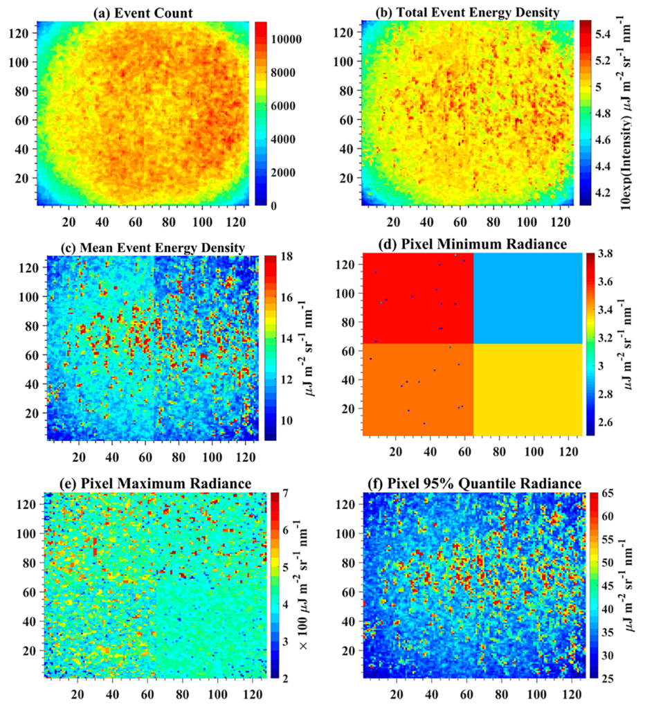
Fig. 12. The VZA-COLD detection results of a selected pixel, and high resolution images for Puerto Rico. (a) The accumulated annual NTL change maps from…
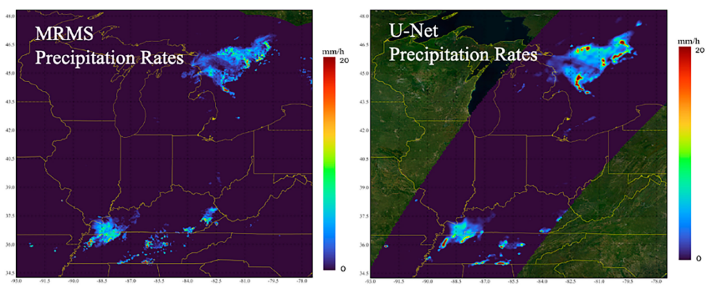
Figure: (Top panel) Rain-Rate predicted by eTRaP and observed by MRMS. (Bottom panel) Scatter plot and estimation metrics for Tropical Storm Fiona between September 18,…
PC: Christoph Trautwein; A scene in the arctic; The halo around the sun is caused by diamond dust in the atmosphere, which overlies clouds. ESSIC/CISESS…
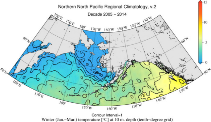
Coastal Alaska was devastated by flooding due to the remnants of Typhoon Merbok (Figure 1a) on September 17, 2022. Storm surge flooded communities along 1,000…
ESSIC/CISESS Scientists Melanie Abecassis and Ronal Vogel received the NESDIS Collaboration Awards for their contributions as part of a team who created new and upgraded…
NOAA Coral Reef Watch’s satellite Bleaching Alert Area product shows high heat stress persists in the South and East China Seas, impacting coral reefs throughout…
Caption: Example experimental v4.0 daily global 5km satellite Bleaching Alert Area product map from September 2, 2022. NOAA Coral Reef Watch (CRW) has released a…
ESSIC/CISESS Scientist Qingyuan Zhang has collaborated with NOAA’s Sean Helfrich (STAR/SMCD) to explore and document the Red River flood in 2022. The Red River flows…
ESSIC/CISESS scientist Daile Zhang was invited to serve on the Board of Directors and Executive Committee of the African Centres for Lightning and Electromagnetics Network…