")
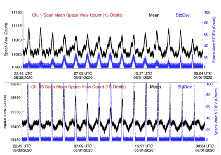
Accurate and Stable Radiometric Calibration of GOES-16 ABI IR Channels
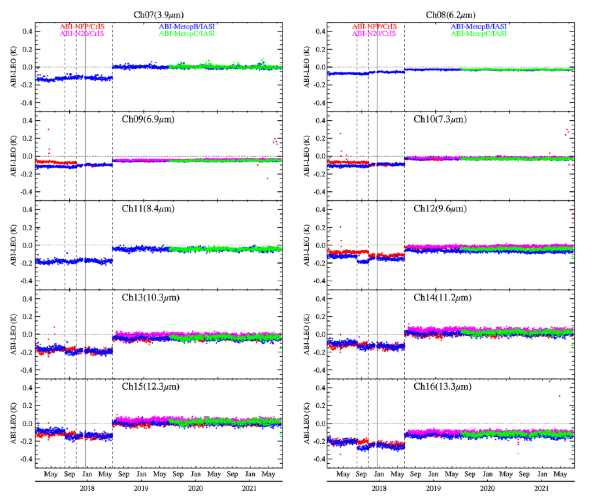
ESSIC/CISESS Scientist Fangfang Yu (STAR/SMCD/SCDAB) has a new article in the Journal of Applied Remote Sensing, co-written with Hyelim Yoo, Haifeng Qian, and Xi Shao. The paper describes the radiometric calibration of the Advanced Baseline Imager (ABI) Infrared (IR) channels on GOES-16.