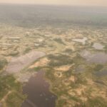
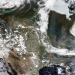
The worst drought to devastate the United States in nearly 50 years struck the fields of the Midwest and High Plains this summer. ESSIC Director and Professor Dr. Antonio Busalacchi was quoted in an article, published on Climate Central, which covered the lack of advanced warning about the drought despite resources at forecasters’ disposal.
In May, according to the article, the U.S. Agriculture Department predicted a record corn yield after farmers planted the largest area of corn and soybeans since 1937. Three months later, after a searing drought engulfed a wide swath of the U.S., those crops lie in ruin.
According to the article, “Despite major advances in seasonal climate forecasting during the past several decades, the failure to predict the scope and severity of the 2012 drought demonstrates that such forecasts are still rife with uncertainty, as forecasters must wrestle with the significant blind spots in their own understanding of the climate system and computer model simulations of that system.”
The lack of warning made the drought especially damaging to both farmers and ranchers who had been expecting a season of plenty, according to the article.
Between May 1 and July 24, the drought footprint in the lower 48 states expanded from an already high 38 percent to a devastating 64 percent, including nearly the entire corn and soybean growing region.
Busalacchi told Climate Central the severity and magnitude of the drought “caught everybody by surprise.”
“Our ability to predict drought on seasonal timescales is not very good,” Busalacchi said.
According to the article, “Climate forecasters and researchers said that there were signs that the summer of 2012 could feature more widespread drought conditions, since water temperatures in a large part of the Pacific Ocean were cooler than average, and Atlantic water temperatures were warmer than average. Such an arrangement has been linked to major droughts in the past because of the way it influences the formation and movement of weather systems across the U.S. Such a sea surface temperature pattern was in place during a severe drought in 1988, for example. However, just because this sea surface temperature pattern is in place doesn’t guarantee drought development”
Busalacchi said the sea surface temperature pattern “would suggest drought,” but that forecasters completely missed the scale and scope of the disaster that has been unfolding during the past few months.


