")
Beneath the Clouds: Super Typhoon Haiyan Observed by AMSR2

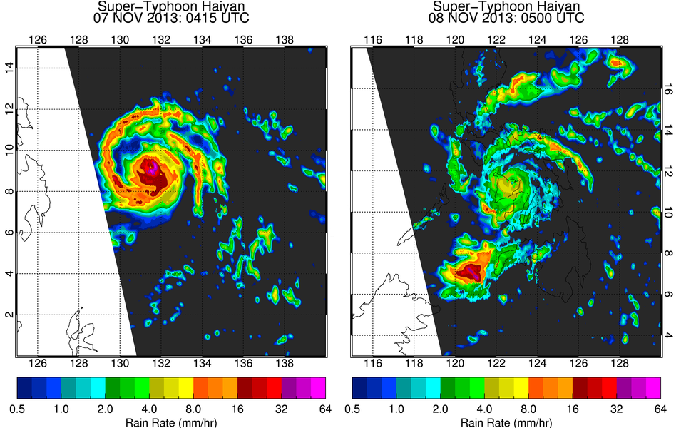
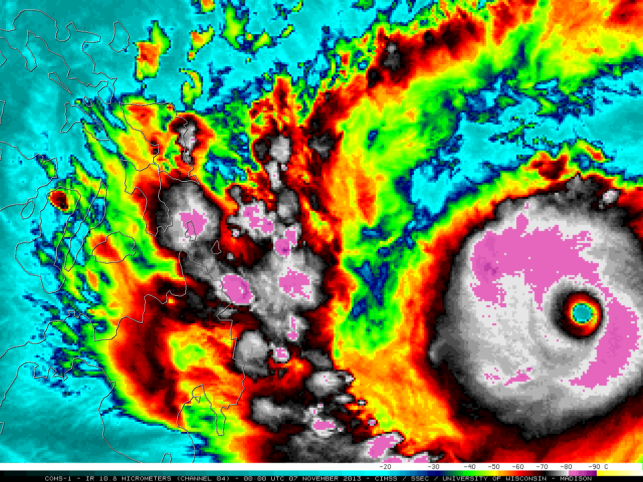
Infrared imagery of Super Typhoon Haiyan shows stunning symmetry (link: CIMSS Satellite Blog). Haiyan is categorized as an annular tropical cyclone, given its “donut” shape. Despite the uniform appearance from infrared imagery, observations from passive microwave sensors paint a more asymmetrical picture (inset). Microwave sensors, such as the Advanced Microwave Scanning Radiometer 2 (AMSR2), are able to see through the upper cloud deck and identify regions of precipitation based on the electromagnetic signal emitted from the rain drops. The imagery from AMSR2 before Haiyan’s landfall shows the heaviest precipitation around the entire eye wall (left). A spiraling rain band emanates from the southern eye wall clockwise around the storm, where it splits into two unique bands. After landfall (right), Haiyan became disorganized as it interacted with the topography of the Philippines and lost energy input from the ocean.
The satellite images typically shown on TV are from geostationary satellites. These sit over the same spot over earth 22,000 miles away and can continually watch the storm. Geostationary satellites measure the top of the clouds, so you can get an idea of where the tallest clouds are. In hurricanes, the entire storm is made up of high clouds so it is difficult to identify where the rain is heaviest and the internal structure of the storm. AMSR2 and other polar-orbiting satellites are much closer to Earth, only 450 miles up. Rather than looking at the top of the clouds, it is able to look through the clouds and detect where the rain droplets exist. Based on the rain distribution and other datasets from passive microwave sensors, forecasters at the National Hurricane Center get a better understanding of the storm structure and if it could intensify. There are sensors similar to AMSR2 aboard other satellites, so the storm is viewed by a passive microwave sensor every 3-4 hours.
AMSR2 is a sensor aboard a Japanese Aerospace Exploration Agency (JAXA) satellite and is part of NOAA’s Joint Polar Satellite System (JPSS). CICS-MD scientists support the JPSS mission by developing, calibrating, and validating geophysical datasets derived from the satellite observations.


