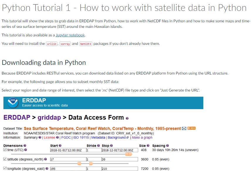
ESSIC/CISESS Scientists Melanie Abecassis and Ron Vogel received the NESDIS Collaboration Award for their contributions to the CoastWatch Satellite Course, part of a team who created new and upgraded existing content exploiting multimedia, and pivoted the course to a virtual environment, hosting educational content on CANVAS at UMD/CISESS.
The course materials include lectures, self-paced tutorials and tool demonstrations. Course resources are publicly available here: https://umd.instructure.com/courses/1332077. The course is followed by a hands-on workshop where participants apply what they have learned to their own projects. Their goal is that, upon course completion, the participants can apply satellite data to projects using their choice of software (e.g. R, Python, ArcGIS). The award ceremony will be held on November 15.
In his research, Vogel applies earth-observation satellite data to environmental decision-making. He currently develops decision-support tools for water quality, fisheries and climate change in coastal areas. Other interests include ecological modeling with satellite data and vegetation and land surface monitoring by satellite. He has expertise in both visible and infrared satellite remote sensing.
Abecassis is part of the NOAA CoastWatch program. Abecassis is a Marine Ecologist with a PhD from the University of Toulouse, France. Melanie’s research interests include animal habitat modeling and understanding endangered species bycatch. In her former role with CoastWatch, she managed the OceanWatch website and data platforms (https://oceanwatch.pifsc.noaa.gov/) to make ocean satellite data available to a wide range of users and now focuses on developing and conducting training workshops to teach users how to use satellite data in their research projects.


