")
Task 238
Quantifying Systematic Errors and Total Uncertainties in Satellite-based Precipitation Measurements
Principal Investigator(s):
Y. Tian
Sponsor(s):
C. Peters-Lidard
Last Updated:
October 26, 2012 15:26:04
Description of Problem
Determining the uncertainties in precipitation measurements by satellite remote sensing is of fundamental importance to many applications. These uncertainties result mostly from the interplay of systematic errors and random errors. Although many satellite-based global precipitation datasets are routinely produced, a quantitative, global picture of their error characteristics is lacking.
Scientific Objectives and Approach
Both systematic errors and total uncertainties have been analyzed for six different TRMM-era precipitation products (3B42, 3B42RT, CMORPH, PERSIANN, NRL and GSMaP). For systematic errors, we devised an error decomposition to separate errors in precipitation estimates into three independent components, hit biases, missed precipitation and false precipitation. This decomposition scheme reveals more error features and provides a better link to the error sources than conventional analysis, because in the latter these error components tend to cancel one another when aggregated or averaged in space or time.
To estimate the measurement uncertainties, we calculated the measurement spread from the ensemble of these six quasi-independent products. A global map of measurement uncertainties was thus produced.
Accomplishments
Our analysis reveals that the six different products share many error features. For example, they all detected strong precipitation (> 40 mm/day) well, but with various biases. They tend to over-estimate in summer and under-estimate in winter. They miss a significant amount of light precipitation (< 10 mm/day). In addition, hit biases and missed precipitation are the two leading error sources. However, their systematic errors also exhibit substantial differences, especially in winter and over rough topography, which greatly contribute to the uncertainties.
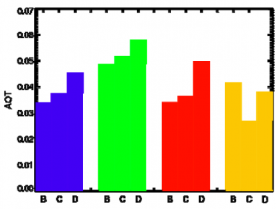
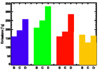
In addition, our uncertainty map yields a global view of the error characteristics and their regional and seasonal variations, and reveals many undocumented error features over areas with no validation data available (Figs 1 and 2). The uncertainties are relatively small (40-60%) over the oceans, especially in the tropics, and over the lower-latitudes in South America. There are large uncertainties (100-140%) over high latitudes (> 40-degree N/S), especially during the cold season. High uncertainties also persist through the seasons over complex terrain, including the Tibetan Plateau, the Rockies and the Andes. Coastlines and water bodies also pose considerable challenges. The global uncertainties also exhibit systematic seasonal, regional as well as rain-rate dependencies, with the lowest uncertainties over tropical oceanic regions with strong, convective precipitation, and the highest ones over wintery, complex land surfaces with light precipitation. In particular, the southeastern U. S. exhibits lower uncertainties. However, large uncertainties (100-140%) exist over high latitude (> 30N) land surfaces, especially during the cold season. Such areas include the northern U. S., most of Europe, and the Tibetan Plateau. The high uncertainties over the Tibetan Plateau also persist through the Northern Hemisphere warm season. In addition, high uncertainties (> 100%) are also associated with the Andes Mountains through all seasons.
Refereed Journal Publications
Tian, Y. and C. D. Peters-Lidard, 2010: A global map of uncertainties in satellite-based precipitation measurements. Geophys. Res. Lett., 37, L24407, doi:10.1029/2010GL046008.
Tian, Y., C. D. Peters-Lidard and J. B. Eylander, 2010: Real-time error reduction for satellite-based precipitation estimates. J. Hydrometeor., 11, 1275-1285.
Tian, Y., J. V. Geiger, H. Su, S. V. Kumar, and P. R. Houser, 2010: Middleware-based sensor web integration. IEEE JSTARS, 3, 467-472, doi:10.1109/JSTARS.2010.2049732.
Yilmaz, K. K., R. F. Adler, Y. Tian, Y. Hong and H. F. Pierce, 2010: Evaluation of a satellite-based global flood monitoring system. Int. J. Remote Sens., 31, 3763–3782.
Tian, Y., C. D. Peters-Lidard, R. F. Adler, T. Kubota, and T. Ushio, 2010: Evaluation of GSMaP precipitation estimates over contiguous U.S. J. Hydrometeor., 11, 566-574.
Other Publications and Conferences
Tian, Y. and C. D. Peters-Lidard, 2010: Quantifying Systematic Errors and Total Uncertainties in Satellite-based Precipitation Measurements. 2010 AGU Fall Meeting, 13-17 December, 2010, San Francisco, CA, USA.
Tian, Y. and C. D. Peters-Lidard, 2010: Quantifying Uncertainties in Satellite-based Global Precipitation Estimates. 5th International Precipitation Working Group Workshop, 11-15 October, 2010, Hamburg, Germany.


