")
Task 224a
A Land Data Assimilation System for Famine Early Warning
Principal Investigator(s):
S. Yatheendradas
Sponsor(s):
C. Peters-Lidard
Last Updated:
October 26, 2012 15:25:51
Description of Problem
This project proposes to enhance the operations of the Famine Early Warning Systems Network (FEWS NET), the US Agency for International Development’s (USAID) decision support system for high priority international food aid programs that safeguard the lives and livelihoods of tens of millions of the world’s poorest and most vulnerable people. This will be done through a unified land modeling and assimilation solution-based integration of a custom instance of NASA’s Land Information System (LIS), specifically for the domains, data streams, and monitoring/forecast requirements associated with food security assessment in data-sparse, developing country settings. This FEWSNET Land Data Assimilation System (FLDAS) will transition into long term, routine use at USGS for FEWS NET decision support, capable of making ensemble runs as the basis for weekly and seasonal forecasts/projections of land surface variables and of direct application of IPCC climate change modeling results to produce 21st century scenarios expressed in terms of land surface variables relevant to FEWS NET food security assessments. Increased specificity and confidence in FEWS NET weekly hazard assessments and seasonal food security outlooks will also be achieved. The science hypothesis interspersed with the human food security dimension is then that the higher quality hydroclimatic modeling made possible by FLDAS will lead directly to more accurate food security outlook (FSO) Integrated Phase Classification (IPC) maps of food security and humanitarian action officials.
Scientific Objectives and Approach
The technical approach is composed of three components:
• Implementation of a FEWS NET Land Data Assimilation System (FLDAS) from LIS, including the most up to date software version of the VIC (Variable Infiltration Capacity) land surface model.
• Application of FLDAS with seasonal climate forecasts to model outcomes for rain fed agricultural and pastoralist livelihood systems in the Greater Horn of Africa
• Production of food security outlook (FSO) IPC maps based on the results of (2). Skill scores will be computed for the outlooks by comparison with actual outcomes to determine skill improvement after implementation of FLDAS.
Accomplishments
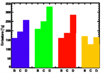
• A LIS rainfall forcing reader of the original CPC/NCEP RFE 2.0 unprojected version (ftp://ftp.cpc.ncep.noaa.gov/fews/newalgo_est/) housed in FEWS NET has been developed. A LIS application over the African domain using this supplemental forcing (GDAS or Global Data Assimilation System is the base forcing) and the Noah land surface model has shown improvement over those obtained by the FEWSNET system. Results for the 2009/2010 rainfall season in Zimbabwe were very encouraging, showing that the LIS ET products compared well with observed crop water deficits and reduced yields (Figure 1). Evaporation fields from the Noah land surface model forced with RFE 2.0 seemed to provide new information in humid areas, as compared with the standard FEWS NET WRSI crop water balance model. These results were received well at the 3rd USGS Modeling Conference in Colorado in June 2010.
• Reader for PET (Potential EvapoTranspiration) forcing is being coded into LIS. The global PET data at http://earlywarning.usgs.gov/fews/Global/web/dwnglobalpet.php is at a coarse resolution (1.0 degree). To obtain the PET from other sources of basic atmospheric forcing at finer resolutions also, the corresponding equations have been converted into F90 from the AML scripts used by USGS and obtained by GSFC, and are also being ported into LIS.
• The land surface component of the FEWS NET software, i.e., the Water Requirement Satisfaction Index (WRSI) model is being coded into LIS by porting from the USGS Visual Basic 2005 (VB.NET) code by Brad Wind, the programmer hired on the project for this task. This also includes special procedures used inside the FEWS NET software to calculate time instances like spatially-varying onset of rains etc. used for the initialization and model run.
• The project is currently intercomparing several sources of precipitation data for application to FEWS-NET in Africa. The FLDAS team at USGS, NASA/GSFC and University of Washington will cooperate with Ben Zaitchik, at the Department of Earth and Planetary Sciences at Johns Hopkins, who is working on LDAS (Land Data Assimilation System) activities for the Nile. The following data products will be examined: the TRMM, CMAP, PERSIANN, RFE2, CMORPH satellite rainfall estimates, and ECMWF, MERRA and Princeton assimilations to identify the best precipitation product for agricultural monitoring in Africa.
Other Publications and Conferences
Verdin, J. P., C. C. Funk, C. Peters-Lidard, S. Yatheendradas and A. McNally (2010), A land data assimilation system for famine early warning, Oral presentation at The 3rd USGS Modeling Conference: Understanding and Predicting for a Changing World, Broomfield, CO.
McNally, A., S. Yatheendradas, C. Peters-Lidard and J. Michaelsen (2010), Improving Agricultural Drought Monitoring in East Africa with Unbiased Rainfall Fields and Detailed Land Surface Physics, Oral presentation at 2010 Fall Meeting, AGU, San Francisco, CA.


