")
Task 224a
A Land Data Assimilation System for Famine Early Warning
Principal Investigator(s):
S. Yatheendradas
Sponsor(s):
C. Peters-Lidard
Last Updated:
October 26, 2012 15:25:52
Description of Problem
The overarching goal was to demonstrate improved accuracy in runoff, stream flow, and flood monitoring and simulation that result from the combination of NASA infrastructure of snow data (MODIS) and model (LIS), with operational NOAA National Weather Service (NWS) River Forecast System (NWSRFS) Decision Support Tools (DST). The objectives were to engineer and integrate NASA satellite- and model-derived land surface products, through the Land Information System (LIS), into NWSRFS DST component models. The specific science question we investigated is whether adjusting modeled snow area with MODIS estimates improves modeled streamflow.
Scientific Objectives and Approach
This work leveraged ongoing NASA/NOAA collaborative research toward the integration of LIS and NWSRFS components (called LIS-RFS), mainly the Sacramento Soil Moisture Accounting (SAC-SMA) and SNOW17 models. With inputs from NOAA/NWS/OHD, NASA/GSFC continuously evaluated the system at successive software integration levels and benchmarked the Distributed Model Intercomparison Project II (DMIP2) Western snow basins in a retrospective simulation mode focusing on the assimilation of NASA remotely sensed MODIS snow covered fraction product. We also introduced a snow masking effect under vegetation canopy present in almost any satellite snow product and also possibly to some extent in model analysis/reanalysis products like the Snow Data Assimilation System (SNODAS).
Accomplishments
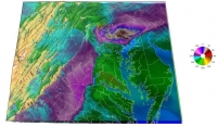
The project work has finished up with the submission in August 2011 of a manuscript to WRR currently under review having the following abstract: " Snow extent affects snowmelt, soil moisture, evapotranspiration, and ultimately basin streamflow. For the Distributed Model Intercomparison Project – Phase 2 Western basins, we assimilate fractional snow extents from satellite (Moderate Resolution Imaging Spectroradiometer or MODIS) into the National Weather Service (NWS) SNOW-17 model. SNOW-17 is used with the NWS Sacramento Heat Transfer Model (SAC-HT) model after porting into the National Aeronautics and Space Administration’s (NASA) Land Information System. SNOW-17 computes snow extents from snow water equivalents (SWEs) using areal depletion curves. Using a first-cut direct insertion, we assimilate snow extents in two fully distributed ways: either we continuously update the curve by preserving SWEs, or we reconstruct SWEs using the curve. The preceding are refinements of an existing simple and conceptually-guided NWS direct insertion algorithm. Satellite snow extent data over densely forested areas contain inaccuracies in below-canopy snow during melt conditions, leading to degraded streamflow simulations upon assimilation. As such, we cautiously implemented a below-canopy allowance during assimilation. Especially for streamflow volume for the uncalibrated basin runs, we obtain: [1] substantial to major improvements (64-81 %) as a percentage of the control run residuals (or distance from observations), and [2] minor improvements (18-22 %) as a percentage of observed values. This shows the potential relevance and value of the assimilation application to ungauged basins. We speculate that snow extent assimilation results should improve further over hydrologically less complex basins, and suggest further improvements for mountainous forested basins in the areas of canopy treatment and snow optical radiative transfer." An example paper Figure is reproduced next, showing the effect of different MODIS snow extent assimilations (e.g., preserving SWE with and without undercanopy snow allowance, recreating SWE etc.) on uncalibrated runs over a Sierra Nevada basin. The comparison against calibrated control run highlights that assimilation could be as effective as calibration for ungaged basins.
Refereed Journal Publications
Yatheendradas, S., et al., Distributed assimilation of satellite-based snow extent for improving simulated streamflow in mountainous, densely forested basins: an application over the DMIP2 western basins , Under Review in Water Resour. Res.


