")
The Geostationary Lightning Mapper (GLM) flash extent density product is rolling out to all National Weather Service forecast offices beginning on Monday, July 16th. The GLM, a device aboard the GOES-16 satellite, is an instrument that maps lightning strikes across the Western Hemisphere. The flash extent density product represents the number of flashes that travel through an area over a given period of time. With this data, weather forecasters will be able to better predict extreme weather and ensure safer decision-making. The product is being distributed via experimental channels, with all offices having access by the end of August. The leader of the development of gridded GLM products at CICS-MD, Scott Rudlosky* appeared on The Weather Channel for two interviews on Monday, July 16th.
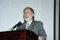
Scott Rudlosky is a SCSB/STAR/NESDIS/NOAA visiting associate research scientist working in collaboration with ESSIC/CICS-MD. He also serves on the National Weather Service (NWS) Lightning Safety Awareness Team and the NWS Total Lightning Implementation Working Group.
To learn more about GLM capabilities and limitations or view sample imagery, visit Dr. Rudlosky’s new Virtual Lab page.
* Cooperative Institute for Climate and Satellites-Maryland, Earth System Science Interdisciplinary Center, University of Maryland


